 |
|
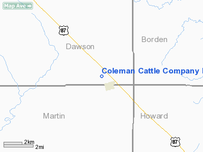
Coleman Cattle Company Nr 1 Airport |
Location & QuickFacts
| FAA Information Effective: | 2008-09-25 |
| Airport Identifier: | 75TA |
| Airport Status: | Operational |
| Longitude/Latitude: | 101-43-30.4920W/32-32-03.3960N
-101.725137/32.534277 (Estimated) |
| Elevation: | 2820 ft / 859.54 m (Estimated) |
| Land: | 0 acres |
| From nearest city: | 1 nautical miles NW of Ackerly, TX |
| Location: | Dawson County, TX |
| Magnetic Variation: | 09E (1985) |
Owner & Manager
| Ownership: | Privately owned |
| Owner: | Coleman Cattle Co. |
| Address: | Box 178
Ackerly, TX 79713 |
| Phone number: | 915-353-4353 |
| Manager: | Mike Coleman |
| Address: | Box 178
Ackerly, TX 79713 |
| Phone number: | 915-353-4353 |
Airport Operations and Facilities
| Airport Use: | Private |
| Wind indicator: | Yes |
| Segmented Circle: | No |
| Control Tower: | No |
| Sectional chart: | Dallas-ft Worth |
| Region: | ASW - Southwest |
| Boundary ARTCC: | ZFW - Fort Worth |
| Tie-in FSS: | FTW - Fort Worth |
| FSS on Airport: | No |
| FSS Phone: | 817-541-3474 |
| FSS Toll Free: | 1-800-WX-BRIEF |
Runway Information
Runway 16/34
| Dimension: | 4725 x 50 ft / 1440.2 x 15.2 m |
| Surface: | ASPH, |
| |
Runway 16 |
Runway 34 |
| Traffic Pattern: | Left | Left |
|
Radio Navigation Aids
| ID |
Type |
Name |
Ch |
Freq |
Var |
Dist |
| LSA | NDB | Lamesa | | 338.00 | 09E | 16.6 nm |
| SDR | NDB | Snyder | | 359.00 | 08E | 40.7 nm |
| ANR | NDB | Andrews | | 245.00 | 09E | 42.6 nm |
| MA | NDB | Farly | | 326.00 | 09E | 44.8 nm |
| BFE | NDB | Brownfield | | 311.00 | 09E | 45.3 nm |
| GNC | NDB | Gaines County | | 344.00 | 09E | 47.3 nm |
| BGS | VORTAC | Big Spring | 090X | 114.30 | 11E | 15.2 nm |
| MAF | VORTAC | Midland | 095X | 114.80 | 11E | 39.4 nm |
| MAF | VOT | Midland International | | 108.20 | | 43.4 nm |
Images and information placed above are from
http://www.airport-data.com/airport/75TA/
We thank them for the data!
| General Info
|
| Country |
United States
|
| State |
TEXAS
|
| FAA ID |
75TA
|
| Latitude |
32-32-03.396N
|
| Longitude |
101-43-30.492W
|
| Elevation |
2820 feet
|
| Near City |
ACKERLY
|
We don't guarantee the information is fresh and accurate. The data may
be wrong or outdated.
For more up-to-date information please refer to other sources.
|
|


