 |
|
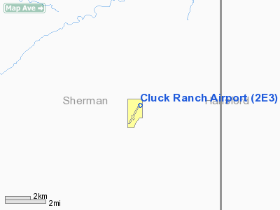
Location & QuickFacts
| FAA Information Effective: | 2008-09-25 |
| Airport Identifier: | 2E3 |
| Airport Status: | Operational |
| Longitude/Latitude: | 101-41-39.9000W/36-10-38.0000N
-101.694417/36.177222 (Estimated) |
| Elevation: | 3423 ft / 1043.33 m (Surveyed) |
| Land: | 116 acres |
| From nearest city: | 17 nautical miles SW of Gruver, TX |
| Location: | Sherman County, TX |
| Magnetic Variation: | 11E (1965) |
Owner & Manager
| Ownership: | Privately owned |
| Owner: | Monte Cluck |
| Address: | 100 Dean Cluck Ave
Gruver, TX 79040 |
| Phone number: | 806-733-5021 |
| Manager: | Monte Cluck |
| Address: | 100 Dean Cluck Ave.
Gruver, TX 79040 |
| Phone number: | 806-733-5021 |
Airport Operations and Facilities
| Airport Use: | Open to public |
| Segmented Circle: | No |
| Control Tower: | No |
| Lighting Schedule: | DUSK-DAWN |
| Beacon Color: | Clear-Green (lighted land airport)
ROTG BCN OTS INDEFLY. |
| Landing fee charge: | No |
| Sectional chart: | Wichita |
| Region: | ASW - Southwest |
| Boundary ARTCC: | ZAB - Albuquerque |
| Tie-in FSS: | FTW - Fort Worth |
| FSS on Airport: | No |
| FSS Phone: | 817-541-3474 |
| FSS Toll Free: | 1-800-WX-BRIEF |
| NOTAMs Facility: | FTW (NOTAM-d service avaliable) |
Airport Communications
Runway Information
Runway 01/19
| Dimension: | 3605 x 35 ft / 1098.8 x 10.7 m |
| Surface: | ASPH, Good Condition
LOOSE GRAVEL ON SURFACE. |
| Weight Limit: | Single wheel: 12500 lbs. |
| |
Runway 01 |
Runway 19 |
| Longitude: | 101-41-47.9410W | 101-41-31.9050W |
| Latitude: | 36-10-21.6800N | 36-10-54.8680N |
| Elevation: | 3423.00 ft | 3417.00 ft |
| Alignment: | 21 | 127 |
| Traffic Pattern: | Left | Left |
| Crossing Height: | 0.00 ft | 18.00 ft |
| VASI: | | tri-color on left side
TRIL OTS INDEFLY. |
| Visual Glide Angle: | 0.00° | 5.00° |
|
Radio Navigation Aids
| ID |
Type |
Name |
Ch |
Freq |
Var |
Dist |
| DUX | NDB | Durrett | | 414.00 | 09E | 24.4 nm |
| GUY | NDB | Guymon | | 275.00 | 09E | 33.0 nm |
| PYX | NDB | Perryton | | 266.00 | 09E | 48.0 nm |
| PPA | NDB | Pampa | | 368.00 | 09E | 48.2 nm |
| BGD | VORTAC | Borger | 023X | 108.60 | 11E | 26.9 nm |
| DHT | VORTAC | Dalhart | 057X | 112.00 | 12E | 41.6 nm |
Images and information placed above are from
http://www.airport-data.com/airport/2E3/
We thank them for the data!
| General Info
|
| Country |
United States
|
| State |
TEXAS
|
| FAA ID |
2E3
|
| Latitude |
36-10-38.000N
|
| Longitude |
101-41-39.900W
|
| Elevation |
3423 feet
|
| Near City |
GRUVER
|
We don't guarantee the information is fresh and accurate. The data may
be wrong or outdated.
For more up-to-date information please refer to other sources.
|
|


