 |
|
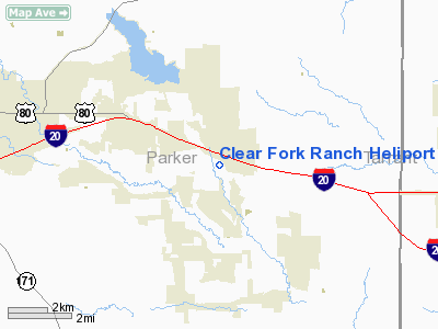
Clear Fork Ranch Heliport |
Location & QuickFacts
| FAA Information Effective: | 2008-09-25 |
| Airport Identifier: | TA54 |
| Airport Status: | Operational |
| Longitude/Latitude: | 097-38-48.0000W/32-44-00.0000N
-97.646667/32.733333 (Estimated) |
| Elevation: | 850 ft / 259.08 m (Estimated) |
| Land: | 0 acres |
| From nearest city: | 15 nautical miles E of Weatherford, TX |
| Location: | Parker County, TX |
| Magnetic Variation: | 07E (1990) |
Owner & Manager
| Ownership: | Privately owned |
| Owner: | Clear Fork |
| Address: | 100 Jenkins Road
Aledo, TX 76008 |
| Phone number: | 817-737-3703 |
| Manager: | A M Micallef, Pres |
| Address: | 4800 Bryant Irvin Court
Fort Worth, TX 76107 |
| Phone number: | 817-737-3703 |
Airport Operations and Facilities
| Airport Use: | Private |
| Wind indicator: | Yes |
| Segmented Circle: | No |
| Control Tower: | No |
| Lighting Schedule: | PHONE REQ
FOR PERIMETER LGTS CALL 817-737-3703. |
| Sectional chart: | Dallas-ft Worth |
| Region: | ASW - Southwest |
| Boundary ARTCC: | ZFW - Fort Worth |
| Tie-in FSS: | FTW - Fort Worth |
| FSS on Airport: | No |
| FSS Phone: | 817-541-3474 |
| FSS Toll Free: | 1-800-WX-BRIEF |
Runway Information
Helipad H1
| Dimension: | 40 x 30 ft / 12.2 x 9.1 m |
| Surface: | CONC, |
| |
Runway H1 |
Runway |
| Traffic Pattern: | Left | Left |
|
Radio Navigation Aids
| ID |
Type |
Name |
Ch |
Freq |
Var |
Dist |
| MWL | NDB | Mineral Wells | | 266.00 | 06E | 21.0 nm |
| XQH | NDB | Cedar Hill | | 353.00 | 08E | 35.0 nm |
| RBD | NDB | Redbird | | 287.00 | 06E | 39.4 nm |
| GZV | NDB | Brazos River | | 280.00 | 07E | 40.9 nm |
| LNC | NDB | Lancaster | | 239.00 | 06E | 47.7 nm |
| NFW | TACAN | Nas Jrb Fort Worth | 024X | | 07E | 10.7 nm |
| TTT | VOR/DME | Maverick | 078X | 113.10 | 06E | 31.7 nm |
| CVE | VOR/DME | Cowboy | 109X | 116.20 | 06E | 38.7 nm |
| MQP | VORTAC | Millsap | 124X | 117.70 | 09E | 17.7 nm |
| FUZ | VORTAC | Ranger | 104X | 115.70 | 06E | 25.4 nm |
| JEN | VORTAC | Glen Rose | 097X | 115.00 | 06E | 36.4 nm |
| UKW | VORTAC | Bowie | 071X | 112.40 | 06E | 49.0 nm |
| FTW | VOT | Fort Worth Meacham | | 108.20 | | 15.4 nm |
| DAL | VOT | Dallas Love Field | | 113.30 | | 40.7 nm |
Remarks
- PRVDD VFR; & THE SLOPING GND N & E OF HELIPAD IS MKD.
Images and information placed above are from
http://www.airport-data.com/airport/TA54/
We thank them for the data!
| General Info
|
| Country |
United States
|
| State |
TEXAS
|
| FAA ID |
TA54
|
| Latitude |
32-44-00.000N
|
| Longitude |
097-38-48.000W
|
| Elevation |
850 feet
|
| Near City |
WEATHERFORD
|
We don't guarantee the information is fresh and accurate. The data may
be wrong or outdated.
For more up-to-date information please refer to other sources.
|
|


