 |
|
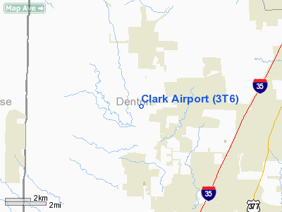
Location & QuickFacts
| FAA Information Effective: | 2008-09-25 |
| Airport Identifier: | 3T6 |
| Airport Status: | Operational |
| Longitude/Latitude: | 097-17-48.0640W/33-08-00.4340N
-97.296684/33.133454 (Estimated) |
| Elevation: | 705 ft / 214.88 m (Estimated) |
| Land: | 20 acres |
| From nearest city: | 3 nautical miles N of Justin, TX |
| Location: | Denton County, TX |
| Magnetic Variation: | 07E (1985) |
Owner & Manager
| Ownership: | Privately owned |
| Owner: | L.e. Clark |
| Address: | 10109 Clark Airfield Road
Justin, TX 76247 |
| Phone number: | 817-648-2264 |
| Manager: | L.e. Clark |
| Address: | 10109 Clark Airfield Road
Justin, TX 76247 |
| Phone number: | 817-648-2264 |
Airport Operations and Facilities
| Airport Use: | Open to public |
| Wind indicator: | Yes |
| Segmented Circle: | No |
| Control Tower: | No |
| Landing fee charge: | No |
| Sectional chart: | Dallas-ft Worth |
| Region: | ASW - Southwest |
| Boundary ARTCC: | ZFW - Fort Worth |
| Tie-in FSS: | FTW - Fort Worth |
| FSS on Airport: | No |
| FSS Phone: | 817-541-3474 |
| FSS Toll Free: | 1-800-WX-BRIEF |
| NOTAMs Facility: | FTW (NOTAM-d service avaliable) |
Airport Communications
Airport Services
Runway Information
Runway 17/35
| Dimension: | 1800 x 22 ft / 548.6 x 6.7 m |
| Surface: | ASPH, |
| |
Runway 17 |
Runway 35 |
| Traffic Pattern: | Left | Left |
| Obstruction: | 3 ft fence, 50.0 ft from runway | , 50.0 ft from runway |
|
Radio Navigation Aids
| ID |
Type |
Name |
Ch |
Freq |
Var |
Dist |
| RBD | NDB | Redbird | | 287.00 | 06E | 34.8 nm |
| GLE | NDB | Gainesville | | 330.00 | 06E | 35.5 nm |
| XQH | NDB | Cedar Hill | | 353.00 | 08E | 36.4 nm |
| GMZ | NDB | Grindstone Mountain | | 356.00 | 07E | 37.1 nm |
| PQF | NDB | Mesquite | | 248.00 | 06E | 43.3 nm |
| MWL | NDB | Mineral Wells | | 266.00 | 06E | 43.7 nm |
| LNC | NDB | Lancaster | | 239.00 | 06E | 44.3 nm |
| JUG | NDB | Jecca | | 388.00 | 06E | 47.7 nm |
| NFW | TACAN | Nas Jrb Fort Worth | 024X | | 07E | 22.9 nm |
| TTT | VOR/DME | Maverick | 078X | 113.10 | 06E | 20.5 nm |
| CVE | VOR/DME | Cowboy | 109X | 116.20 | 06E | 24.6 nm |
| FUZ | VORTAC | Ranger | 104X | 115.70 | 06E | 15.8 nm |
| UKW | VORTAC | Bowie | 071X | 112.40 | 06E | 35.8 nm |
| MQP | VORTAC | Millsap | 124X | 117.70 | 09E | 43.0 nm |
| FTW | VOT | Fort Worth Meacham | | 108.20 | | 19.2 nm |
| DAL | VOT | Dallas Love Field | | 113.30 | | 28.3 nm |
Remarks
- COMPATIBLE TRAFFIC PATTERNS W/SHARP ARPT. NORTH THRESHOLD DSPLCD TO PROVIDE CLEARANCE OVR ROAD.
Images and information placed above are from
http://www.airport-data.com/airport/3T6/
We thank them for the data!
|
|


