 |
|
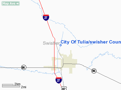
City Of Tulia/swisher County Muni Airport |
Location & QuickFacts
| FAA Information Effective: | 2008-09-25 |
| Airport Identifier: | I06 |
| Airport Status: | Operational |
| Longitude/Latitude: | 101-46-53.2600W/34-34-00.5690N
-101.781461/34.566825 (Estimated) |
| Elevation: | 3503 ft / 1067.71 m (Surveyed) |
| Land: | 140 acres |
| From nearest city: | 2 nautical miles NW of Tulia, TX |
| Location: | Swisher County, TX |
| Magnetic Variation: | 09E (1985) |
Owner & Manager
| Ownership: | Publicly owned |
| Owner: | Cty Of Tulia & Swisher County |
| Address: | City Hall, 127 S.w. 2nd
Tulia, TX 79088 |
| Phone number: | 806-995-3547 |
| Manager: | Judge Harold Keeter |
| Address: | 119 S. Maxwell
Tulia, TX 79088 |
| Phone number: | 806-995-3504 |
Airport Operations and Facilities
| Airport Use: | Open to public |
| Wind indicator: | Yes |
| Segmented Circle: | Yes |
| Control Tower: | No |
| Lighting Schedule: | DUSK-DAWN
MIRL RY 18/36 PRESET LOW INTST; TO INCR INTST ACTVT - 122.8. |
| Beacon Color: | Clear-Green (lighted land airport) |
| Landing fee charge: | No |
| Sectional chart: | Dallas-ft Worth |
| Region: | ASW - Southwest |
| Boundary ARTCC: | ZFW - Fort Worth |
| Tie-in FSS: | FTW - Fort Worth |
| FSS on Airport: | No |
| FSS Phone: | 817-541-3474 |
| FSS Toll Free: | 1-800-WX-BRIEF |
| NOTAMs Facility: | FTW (NOTAM-d service avaliable) |
| Federal Agreements: | NGY |
Airport Communications
| CTAF: | 122.700 |
| Unicom: | 122.700 |
Airport Services
| Fuel available: | 100LL
FUEL AVBL WITH CREDIT CARD. FOR ASSISTANCE CALL 806-627-7719 . |
| Bottled Oxygen: | NONE |
| Bulk Oxygen: | NONE |
Runway Information
Runway 18/36
| Dimension: | 4900 x 60 ft / 1493.5 x 18.3 m |
| Surface: | ASPH, Good Condition |
| Weight Limit: | Single wheel: 12500 lbs. |
| Edge Lights: | Medium |
| |
Runway 18 |
Runway 36 |
| Longitude: | 101-46-46.4600W | 101-47-00.0600W |
| Latitude: | 34-34-24.0180N | 34-33-37.1190N |
| Elevation: | 3488.00 ft | 3503.00 ft |
| Traffic Pattern: | Left | Left |
| Markings: | Non-precision instrument, Good Condition | Non-precision instrument, Good Condition |
| Obstruction: | , 50:1 slope to clear | 15 ft road, 550.0 ft from runway, 160 ft right of centerline, 23:1 slope to clear |
|
Radio Navigation Aids
| ID |
Type |
Name |
Ch |
Freq |
Var |
Dist |
| HRX | NDB | Hereford | | 341.00 | 09E | 32.0 nm |
| AM | NDB | Pande | | 251.00 | 09E | 34.9 nm |
| LIU | NDB | Littlefield | | 212.00 | 10E | 49.2 nm |
| PVW | VOR/DME | Plainview | 076X | 112.90 | 11E | 28.9 nm |
| PNH | VORTAC | Panhandle | 113X | 116.60 | 08E | 40.4 nm |
Images and information placed above are from
http://www.airport-data.com/airport/I06/
We thank them for the data!
| General Info
|
| Country |
United States
|
| State |
TEXAS
|
| FAA ID |
I06
|
| Time |
UTC-6(-5DT)
|
| Latitude |
34.566825
34° 34' 00.57" N
|
| Longitude |
-101.781461
101° 46' 53.26" W
|
| Elevation |
3503 feet
1068 meters
|
| Magnetic Variation |
007° E (01/06)
|
| Beacon |
Yes
|
| Operating Agency |
U.S.CIVIL AIRPORT WHEREIN PERMIT COVERS USE BY TRANSIT MILITARY AIRCRAFT
|
| Near City |
Tulia
|
| Operating Hours |
SEE REMARKS FOR OPERATING HOURS OR COMMUNICATIONS FOR POSSIBLE HOURS
|
| Daylight Saving Time |
Second Sunday in March at 0200 to first Sunday in November at 0200 local time (Exception Arizona and that portion of Indiana in the Eastern Time Zone)
|
We don't guarantee the information is fresh and accurate. The data may
be wrong or outdated.
For more up-to-date information please refer to other sources.
|
|


