 |
|
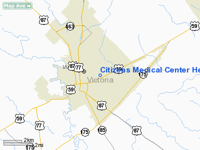
Citizens Medical Center Heliport |
Location & QuickFacts
| FAA Information Effective: | 2008-09-25 |
| Airport Identifier: | 3XS2 |
| Airport Status: | Operational |
| Longitude/Latitude: | 096-58-34.9510W/28-48-50.9610N
-96.976375/28.814156 (Estimated) |
| Elevation: | 95 ft / 28.96 m (Estimated) |
| Land: | 0 acres |
| From nearest city: | 0 nautical miles N of Victoria, TX |
| Location: | Victoria County, TX |
| Magnetic Variation: | 07E (1985) |
Owner & Manager
| Ownership: | Privately owned |
| Owner: | Citizens Medical Center |
| Address: | 2701 Hospital Dr
Victoria, TX 77901 |
| Phone number: | 512-573-9181 |
| Manager: | D. P. Brown |
| Address: | 2701 Hospital Dr
Victoria, TX 77901 |
| Phone number: | 512-573-9181 |
Airport Operations and Facilities
| Airport Use: | Private
MEDICAL. |
| Wind indicator: | Yes |
| Segmented Circle: | No |
| Control Tower: | No |
| Lighting Schedule: | DUSK-DAWN |
| Landing fee charge: | No |
| Sectional chart: | Houston |
| Region: | ASW - Southwest |
| Boundary ARTCC: | ZHU - Houston |
| Tie-in FSS: | CXO - Montgomery County |
| FSS on Airport: | No |
| FSS Toll Free: | 1-800-WX-BRIEF
FOR FP FILING CALL CXO FSS 1-800-833-5602. |
Airport Communications
Runway Information
Helipad H1
| Dimension: | 100 x 50 ft / 30.5 x 15.2 m
WITHIN A 100' X 150' FENCED AREA. |
| Surface: | CONC, |
| |
Runway H1 |
Runway |
| Traffic Pattern: | Left | Left |
|
Radio Navigation Aids
| ID |
Type |
Name |
Ch |
Freq |
Var |
Dist |
| PKV | NDB | Port Lavaca | | 515.00 | 05E | 18.4 nm |
| OKT | NDB | Yoakum | | 350.00 | 06E | 31.1 nm |
| MNO | NDB | Mellon Ranch | | 375.00 | 06E | 34.3 nm |
| RKP | NDB | Rockport | | 391.00 | 06E | 43.7 nm |
| VCT | VOR/DME | Victoria | 027X | 109.00 | 06E | 5.2 nm |
| PSX | VORTAC | Palacios | 120X | 117.30 | 08E | 35.4 nm |
Remarks
- VFR OPNS ONLY; IN/OUT CONFINED TO E/W OR NE/W DIR TO MIN NOISE AFFECTING VICTORIA COLLEGE; LOW FLYOVERS OF RES AREAS SHOULD BE AVOIDED TO MIN NOISE.
Images and information placed above are from
http://www.airport-data.com/airport/3XS2/
We thank them for the data!
| General Info
|
| Country |
United States
|
| State |
TEXAS
|
| FAA ID |
3XS2
|
| Latitude |
28-48-50.961N
|
| Longitude |
096-58-34.951W
|
| Elevation |
95 feet
|
| Near City |
VICTORIA
|
We don't guarantee the information is fresh and accurate. The data may
be wrong or outdated.
For more up-to-date information please refer to other sources.
|
|


