 |
|
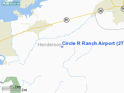
Location & QuickFacts
| FAA Information Effective: | 2008-09-25 |
| Airport Identifier: | 2TS4 |
| Airport Status: | Operational |
| Longitude/Latitude: | 095-58-13.0000W/32-08-23.0000N
-95.970278/32.139722 (Estimated) |
| Elevation: | 395 ft / 120.40 m (Estimated) |
| Land: | 0 acres |
| From nearest city: | 3 nautical miles SE of Malakoff, TX |
| Location: | Henderson County, TX |
| Magnetic Variation: | 06E (1985) |
Owner & Manager
| Ownership: | Privately owned |
| Owner: | Stewart B Cochran |
| Address: | 8017 County Rd 1201
Malakoff, TX 75148 |
| Phone number: | 903-489-2022 |
| Manager: | Stewart B Cochran |
| Address: | 8017 County Rd 1201
Malakoff, TX 75148 |
| Phone number: | 903-489-2022 |
Airport Operations and Facilities
| Airport Use: | Private |
| Wind indicator: | Yes |
| Segmented Circle: | No |
| Control Tower: | No |
| Lighting Schedule: | RDO-CTL
ACTVT LIRL RY 17/35 - 122.7. |
| Sectional chart: | Dallas-ft Worth |
| Region: | ASW - Southwest |
| Boundary ARTCC: | ZFW - Fort Worth |
| Tie-in FSS: | FTW - Fort Worth |
| FSS Phone: | 817-541-3474 |
| FSS Toll Free: | 1-800-WX-BRIEF |
Airport Communications
Airport Services
Runway Information
Runway 17/35
| Dimension: | 3000 x 60 ft / 914.4 x 18.3 m |
| Surface: | TURF, Good Condition |
| Edge Lights: | Low |
| |
Runway 17 |
Runway 35 |
| Traffic Pattern: | Left | Left |
|
Radio Navigation Aids
| ID |
Type |
Name |
Ch |
Freq |
Var |
Dist |
| CSZ | NDB | Crossroads | | 215.00 | 08E | 4.6 nm |
| AHX | NDB | Athens | | 269.00 | 06E | 7.2 nm |
| LIQ | NDB | Lochridge Ranch | | 335.00 | 09E | 7.8 nm |
| PYF | NDB | Pyramid | | 418.00 | 06E | 20.3 nm |
| CRS | NDB | Corsicana | | 396.00 | 06E | 22.7 nm |
| CGQ | NDB | Powell | | 344.00 | 06E | 23.7 nm |
| PSN | NDB | Palestine | | 375.00 | 04E | 25.6 nm |
| TY | NDB | Tyler | | 320.00 | 06E | 30.4 nm |
| AVZ | NDB | Travis | | 260.00 | 06E | 39.9 nm |
| LXY | NDB | Mexia | | 329.00 | 07E | 40.8 nm |
| JSO | NDB | Cherokee County | | 263.00 | 05E | 41.7 nm |
| JUG | NDB | Jecca | | 388.00 | 06E | 42.7 nm |
| LNC | NDB | Lancaster | | 239.00 | 06E | 46.3 nm |
| PQF | NDB | Mesquite | | 248.00 | 06E | 49.2 nm |
| FZT | VOR/DME | Frankston | 051X | 111.40 | 06E | 22.7 nm |
| TYR | VOR/DME | Tyler | 089X | 114.20 | 06E | 31.6 nm |
| GNL | VOR/DME | Groesbeck | 025X | 108.80 | 05E | 44.7 nm |
| CQY | VORTAC | Cedar Creek | 095X | 114.80 | 06E | 12.9 nm |
Images and information placed above are from
http://www.airport-data.com/airport/2TS4/
We thank them for the data!
| General Info
|
| Country |
United States
|
| State |
TEXAS
|
| FAA ID |
2TS4
|
| Latitude |
32-08-23.000N
|
| Longitude |
095-58-13.000W
|
| Elevation |
395 feet
|
| Near City |
MALAKOFF
|
We don't guarantee the information is fresh and accurate. The data may
be wrong or outdated.
For more up-to-date information please refer to other sources.
|
|


