 |
|
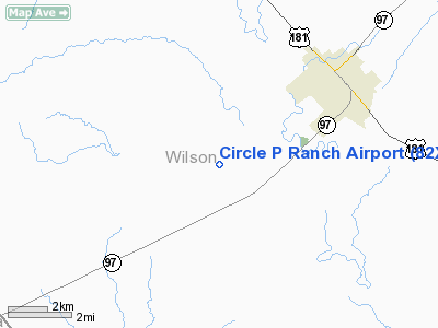
Location & QuickFacts
| FAA Information Effective: | 2008-09-25 |
| Airport Identifier: | 82XS |
| Airport Status: | Operational |
| Longitude/Latitude: | 098-13-00.0300W/29-06-09.8800N
-98.216675/29.102744 (Estimated) |
| Elevation: | 500 ft / 152.40 m (Estimated) |
| Land: | 18 acres |
| From nearest city: | 30 nautical miles SE of Floresville, TX |
| Location: | Wilson County, TX |
| Magnetic Variation: | 06E (2000) |
Owner & Manager
| Ownership: | Privately owned |
| Owner: | David Cavender |
| Address: | Po Box 22
Floresville, TX 78114 |
| Phone number: | 830-393-9045 |
| Manager: | David Cavender |
| Address: | Po Box 22
Floresville, TX 78114 |
| Phone number: | 830-393-9045 |
Airport Operations and Facilities
| Airport Use: | Private |
| Wind indicator: | Yes |
| Segmented Circle: | No |
| Control Tower: | No |
| Sectional chart: | San Antonio |
| Region: | ASW - Southwest |
| Boundary ARTCC: | ZHU - Houston |
| Tie-in FSS: | SJT - San Angelo |
| FSS Toll Free: | 1-800-WX-BRIEF |
Runway Information
Runway 04/22
| Dimension: | 2600 x 120 ft / 792.5 x 36.6 m |
| Surface: | TURF, |
| |
Runway 04 |
Runway 22 |
| Traffic Pattern: | Left | Left |
|
Radio Navigation Aids
| ID |
Type |
Name |
Ch |
Freq |
Var |
Dist |
| PEZ | NDB | Pleasanton | | 275.00 | 07E | 18.2 nm |
| CVB | NDB | Castroville | | 338.00 | 08E | 36.3 nm |
| HHH | NDB | Devine | | 359.00 | 07E | 38.0 nm |
| BEA | NDB | Beeville | | 284.00 | 07E | 49.4 nm |
| KSY | TACAN | Kelly | 057X | | 07E | 25.8 nm |
| DHK | TACAN | Randolph | 036X | | 09E | 26.2 nm |
| SSF | VOR | Stinson | | 108.40 | 09E | 15.1 nm |
| RND | VORTAC | Randolph | 70X | 112.30 | 09E | 25.3 nm |
| SAT | VORTAC | San Antonio | 115X | 116.80 | 08E | 35.0 nm |
| THX | VORTAC | Three Rivers | 051X | 111.40 | 08E | 36.1 nm |
| SAT | VOT | San Antonio Intl | | 110.40 | | 29.1 nm |
Remarks
- PRVDD REFLECTIVE BALLS INSTALLED ON ALL WIRES & PLINES CLOSE TO THE ARPT.
Images and information placed above are from
http://www.airport-data.com/airport/82XS/
We thank them for the data!
| General Info
|
| Country |
United States
|
| State |
TEXAS
|
| FAA ID |
41TA
|
| Latitude |
32-14-15.510N
|
| Longitude |
097-52-41.115W
|
| Elevation |
800 feet
|
| Near City |
GLEN ROSE
|
We don't guarantee the information is fresh and accurate. The data may
be wrong or outdated.
For more up-to-date information please refer to other sources.
|
|


