 |
|
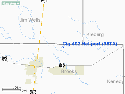
Location & QuickFacts
| FAA Information Effective: | 2008-09-25 |
| Airport Identifier: | 98TX |
| Airport Status: | Operational |
| Longitude/Latitude: | 098-05-39.0130W/27-15-24.1520N
-98.094170/27.256709 (Estimated) |
| Elevation: | 110 ft / 33.53 m (Estimated) |
| Land: | 0 acres |
| From nearest city: | 5 nautical miles NE of Falfurrias, TX |
| Location: | Brooks County, TX |
| Magnetic Variation: | 07E (1990) |
Owner & Manager
| Ownership: | Privately owned |
| Owner: | Channel Industries Gas |
| Address: | 15415 Katy Freeway, Suite 100
Houston, TX 77094 |
| Phone number: | 713-578-4813 |
| Manager: | W.c. Byerly |
| Address: | 15415 Katy Freeway, Suite 100
Houston, TX 77094 |
| Phone number: | 713-578-4813 |
Airport Operations and Facilities
| Airport Use: | Private |
| Segmented Circle: | No |
| Control Tower: | No |
| Sectional chart: | Brownsville |
| Region: | ASW - Southwest |
| Boundary ARTCC: | ZHU - Houston |
| Tie-in FSS: | SJT - San Angelo |
| FSS on Airport: | No |
| FSS Toll Free: | 1-800-WX-BRIEF |
Runway Information
Helipad H1
| Dimension: | 30 x 30 ft / 9.1 x 9.1 m |
| Surface: | TURF, |
| |
Runway H1 |
Runway |
| Traffic Pattern: | Left | Left |
|
Radio Navigation Aids
| ID |
Type |
Name |
Ch |
Freq |
Var |
Dist |
| BKS | NDB | Brooks County | | 353.00 | 06E | 3.3 nm |
| TKB | NDB | Kleberg County | | 347.00 | 06E | 21.0 nm |
| HBV | NDB | Hebbronville | | 266.00 | 06E | 35.2 nm |
| SNE | NDB | Santa Elena | | 260.00 | 07E | 41.4 nm |
| NQI | TACAN | Kingsville | 125X | | 09E | 21.2 nm |
| NOG | TACAN | Orange Grove | 063X | | 09E | 38.5 nm |
| ALI | VOR | Alice | | 114.50 | 06E | 29.3 nm |
| NGP | VORTAC | Truax | 087X | 114.00 | 06E | 49.8 nm |
Remarks
- PRVDD VFR; ALL CABLES & PLINES ARE MKD INVOF FACILITY; A WIND INDICATOR IS MAINTAINED THAT IS IN GOOD CONDITION.
Images and information placed above are from
http://www.airport-data.com/airport/98TX/
We thank them for the data!
| General Info
|
| Country |
United States
|
| State |
TEXAS
|
| FAA ID |
98TX
|
| Latitude |
27-15-24.152N
|
| Longitude |
098-05-39.013W
|
| Elevation |
110 feet
|
| Near City |
FALFURRIAS
|
We don't guarantee the information is fresh and accurate. The data may
be wrong or outdated.
For more up-to-date information please refer to other sources.
|
|


