 |
|
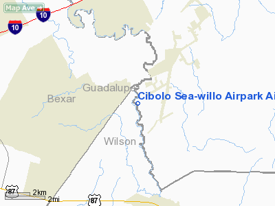
Cibolo Sea-willo Airpark Airport |
Location & QuickFacts
| FAA Information Effective: | 2008-09-25 |
| Airport Identifier: | TE67 |
| Airport Status: | Operational |
| Longitude/Latitude: | 098-07-54.0200W/29-25-44.8400N
-98.131672/29.429122 (Estimated) |
| Elevation: | 517 ft / 157.58 m (Estimated) |
| Land: | 0 acres |
| From nearest city: | 4 nautical miles SW of New Berlin, TX |
| Location: | Guadalupe County, TX |
| Magnetic Variation: | 07E (1995) |
Owner & Manager
| Ownership: | Privately owned |
| Owner: | John L. Bohannon |
| Address: | 9015 Fm 775
Seguin, TX 78155 |
| Phone number: | 830-914-3288 |
| Manager: | John L. Bohannon |
| Address: | 9015 Fm 775
Seguin, TX 78155 |
| Phone number: | 830-420-3491 |
Airport Operations and Facilities
| Airport Use: | Private |
| Wind indicator: | Yes |
| Segmented Circle: | No |
| Control Tower: | No |
| Sectional chart: | San Antonio |
| Region: | ASW - Southwest |
| Boundary ARTCC: | ZHU - Houston |
| Tie-in FSS: | SJT - San Angelo |
| FSS Toll Free: | 1-800-WX-BRIEF |
Runway Information
Runway 16/34
| Dimension: | 2500 x 40 ft / 762.0 x 12.2 m |
| Surface: | ASPH, |
| |
Runway 16 |
Runway 34 |
| Traffic Pattern: | Left | Left |
| Obstruction: | 45 ft trees, 500.0 ft from runway | 30 ft pole, 10.0 ft from runway |
|
Radio Navigation Aids
| ID |
Type |
Name |
Ch |
Freq |
Var |
Dist |
| PEZ | NDB | Pleasanton | | 275.00 | 07E | 35.0 nm |
| CVB | NDB | Castroville | | 338.00 | 08E | 37.9 nm |
| HHH | NDB | Devine | | 359.00 | 07E | 45.8 nm |
| DHK | TACAN | Randolph | 036X | | 09E | 9.6 nm |
| KSY | TACAN | Kelly | 057X | | 07E | 23.6 nm |
| SSF | VOR | Stinson | | 108.40 | 09E | 19.3 nm |
| RND | VORTAC | Randolph | 70X | 112.30 | 09E | 9.7 nm |
| SAT | VORTAC | San Antonio | 115X | 116.80 | 08E | 21.5 nm |
| SAT | VOT | San Antonio Intl | | 110.40 | | 18.8 nm |
Remarks
- PRVDD ALL OPNS INTO AND OUT OF ARPT REMAIN CLEAR OF RANDOLPH AFB ALERT AREA 635.
Images and information placed above are from
http://www.airport-data.com/airport/TE67/
We thank them for the data!
| General Info
|
| Country |
United States
|
| State |
TEXAS
|
| FAA ID |
TE67
|
| Latitude |
29-25-44.840N
|
| Longitude |
098-07-54.020W
|
| Elevation |
517 feet
|
| Near City |
NEW BERLIN
|
We don't guarantee the information is fresh and accurate. The data may
be wrong or outdated.
For more up-to-date information please refer to other sources.
|
|


