 |
|
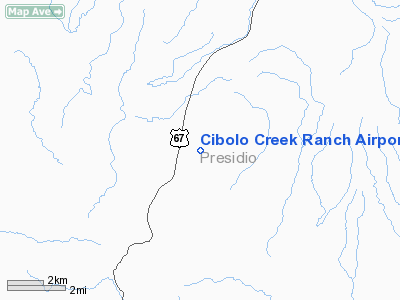
Cibolo Creek Ranch Airport |
Location & QuickFacts
| FAA Information Effective: | 2008-09-25 |
| Airport Identifier: | TS15 |
| Airport Status: | Operational |
| Longitude/Latitude: | 104-15-41.7000W/29-53-34.6150N
-104.261583/29.892949 (Estimated) |
| Elevation: | 4400 ft / 1341.12 m (Estimated) |
| Land: | 0 acres |
| From nearest city: | 33 nautical miles SS of Marfa, TX |
| Location: | Presidio County, TX |
| Magnetic Variation: | 09E (1990) |
Owner & Manager
| Ownership: | Privately owned |
| Owner: | Southwestern Holdings |
| Address: | 1100 Louisiana, Suite 3650
Houston, TX 77002 |
| Phone number: | 713-655-9800 |
| Manager: | Scott Mcgehee
CIBOLO CREEK RANCH VP AND GENERAL MANAGER. |
| Address: | Hcr 67 Box 44
Marfa, TX 79843 |
| Phone number: | 432-229-3737 |
Airport Operations and Facilities
| Airport Use: | Private |
| Wind indicator: | Yes |
| Segmented Circle: | No |
| Control Tower: | No |
| Sectional chart: | El Paso |
| Region: | ASW - Southwest |
| Boundary ARTCC: | ZAB - Albuquerque |
| Tie-in FSS: | SJT - San Angelo |
| FSS on Airport: | No |
| FSS Toll Free: | 1-800-WX-BRIEF |
Airport Services
Runway Information
Runway 09/27
| Dimension: | 5300 x 60 ft / 1615.4 x 18.3 m |
| Surface: | CALICHE, |
| |
Runway 09 |
Runway 27 |
| Traffic Pattern: | Left | Left |
|
Radio Navigation Aids
| ID |
Type |
Name |
Ch |
Freq |
Var |
Dist |
| BWR | NDB | Brewster County | | 412.00 | 09E | 46.6 nm |
| MRF | VOR/DME | Marfa | 106X | 115.90 | 11E | 29.1 nm |
Images and information placed above are from
http://www.airport-data.com/airport/TS15/
We thank them for the data!
| General Info
|
| Country |
United States
|
| State |
TEXAS
|
| FAA ID |
TS15
|
| Latitude |
29-53-34.615N
|
| Longitude |
104-15-41.700W
|
| Elevation |
4400 feet
|
| Near City |
PRESIDIO
|
We don't guarantee the information is fresh and accurate. The data may
be wrong or outdated.
For more up-to-date information please refer to other sources.
|
|


