 |
|
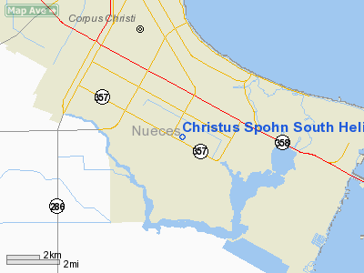
Christus Spohn South Heliport |
Location & QuickFacts
| FAA Information Effective: | 2008-09-25 |
| Airport Identifier: | 1XA3 |
| Airport Status: | Operational |
| Longitude/Latitude: | 097-22-37.8000W/27-41-05.4000N
-97.377167/27.684833 (Estimated) |
| Elevation: | 24 ft / 7.32 m (Estimated) |
| Land: | 0 acres |
| From nearest city: | 5 nautical miles S of Corpus Christi, TX |
| Location: | Nueces County, TX |
| Magnetic Variation: | () |
Owner & Manager
| Ownership: | Privately owned |
| Owner: | Christus Spohn Health System |
| Address: | 5950 Saratoga Blvd
Corpus Christi, TX 78418 |
| Phone number: | 361-985-5105 |
| Manager: | Mike T. Johnson |
| Address: | 5950 Saratoga Blvd
Corpus Christi, TX 78414 |
| Phone number: | 361-985-5105 |
Airport Operations and Facilities
| Airport Use: | Private
MEDICAL USE. |
| Control Tower: | No |
| Lighting Schedule: | DUSK-DAWN |
| Sectional chart: | Brownsville |
| Region: | ASW - Southwest |
| Boundary ARTCC: | ZHU - Houston |
| Tie-in FSS: | SJT - San Angelo |
| FSS Toll Free: | 1-800-WX-BRIEF |
Runway Information
Helipad H1
| Dimension: | 54 x 54 ft / 16.5 x 16.5 m |
| Surface: | CONC, |
| |
Runway H1 |
Runway |
| Traffic Pattern: | Left | Left |
|
Radio Navigation Aids
| ID |
Type |
Name |
Ch |
Freq |
Var |
Dist |
| RKP | NDB | Rockport | | 391.00 | 06E | 30.1 nm |
| MNO | NDB | Mellon Ranch | | 375.00 | 06E | 36.9 nm |
| TKB | NDB | Kleberg County | | 347.00 | 06E | 38.0 nm |
| BEA | NDB | Beeville | | 284.00 | 07E | 46.7 nm |
| BKS | NDB | Brooks County | | 353.00 | 06E | 49.0 nm |
| NQI | TACAN | Kingsville | 125X | | 09E | 25.4 nm |
| NOG | TACAN | Orange Grove | 063X | | 09E | 37.6 nm |
| ALI | VOR | Alice | | 114.50 | 06E | 34.4 nm |
| NGP | VORTAC | Truax | 087X | 114.00 | 06E | 4.4 nm |
| CRP | VORTAC | Corpus Christi | 102X | 115.50 | 09E | 13.6 nm |
Remarks
- OWNER DESIRES ARPT NOT BE CHARTED.
Images and information placed above are from
http://www.airport-data.com/airport/1XA3/
We thank them for the data!
|
|


