 |
|
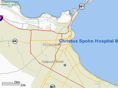
Christus Spohn Hospital Memorial Heliport |
Location & QuickFacts
| FAA Information Effective: | 2008-09-25 |
| Airport Identifier: | 0TE1 |
| Airport Status: | Operational |
| Longitude/Latitude: | 097-24-50.9720W/27-46-47.1000N
-97.414159/27.779750 (Estimated) |
| Elevation: | 38 ft / 11.58 m (Estimated) |
| Land: | 0 acres |
| From nearest city: | 0 nautical miles N of Corpus Christi, TX |
| Location: | Nueces County, TX |
| Magnetic Variation: | 07E (1985) |
Owner & Manager
| Ownership: | Publicly owned |
| Owner: | Memorial Medical Center |
| Address: | Po Box 5280
Corpus Christi, TX 78405 |
| Phone number: | 512-902-4000 |
| Manager: | J Westley
DIRECTOR OF ENGINEERING |
| Address: | Po Box 5280
Corpus Christi, TX 78405 |
| Phone number: | 512-902-4910 |
Airport Operations and Facilities
| Airport Use: | Private
MEDICAL. |
| Wind indicator: | Yes |
| Segmented Circle: | No |
| Control Tower: | No |
| Lighting Schedule: | DUSK-DAWN |
| Beacon Color: | Clear-Green-Yellow (heliport) |
| Landing fee charge: | No |
| Sectional chart: | Brownsville |
| Region: | ASW - Southwest |
| Boundary ARTCC: | ZHU - Houston |
| Tie-in FSS: | SJT - San Angelo |
| FSS on Airport: | No |
| FSS Toll Free: | 1-800-WX-BRIEF |
Runway Information
Helipad H1
| Dimension: | 100 x 100 ft / 30.5 x 30.5 m |
| Surface: | DIRT, |
| |
Runway H1 |
Runway |
| Traffic Pattern: | Left | Left |
|
Radio Navigation Aids
| ID |
Type |
Name |
Ch |
Freq |
Var |
Dist |
| RKP | NDB | Rockport | | 391.00 | 06E | 27.0 nm |
| MNO | NDB | Mellon Ranch | | 375.00 | 06E | 32.0 nm |
| TKB | NDB | Kleberg County | | 347.00 | 06E | 37.2 nm |
| BEA | NDB | Beeville | | 284.00 | 07E | 40.8 nm |
| NQI | TACAN | Kingsville | 125X | | 09E | 26.8 nm |
| NOG | TACAN | Orange Grove | 063X | | 09E | 34.1 nm |
| ALI | VOR | Alice | | 114.50 | 06E | 32.4 nm |
| CRP | VORTAC | Corpus Christi | 102X | 115.50 | 09E | 7.6 nm |
| NGP | VORTAC | Truax | 087X | 114.00 | 06E | 8.5 nm |
Images and information placed above are from
http://www.airport-data.com/airport/0TE1/
We thank them for the data!
| General Info
|
| Country |
United States
|
| State |
TEXAS
|
| FAA ID |
0TE1
|
| Latitude |
27-46-47.100N
|
| Longitude |
097-24-50.972W
|
| Elevation |
38 feet
|
| Near City |
CORPUS CHRISTI
|
We don't guarantee the information is fresh and accurate. The data may
be wrong or outdated.
For more up-to-date information please refer to other sources.
|
|


