 |
|
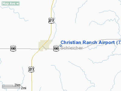
Location & QuickFacts
| FAA Information Effective: | 2008-09-25 |
| Airport Identifier: | 7XS5 |
| Airport Status: | Operational |
| Longitude/Latitude: | 100-33-59.8400W/30-51-37.1200N
-100.566622/30.860311 (Estimated) |
| Elevation: | 2425 ft / 739.14 m (Estimated) |
| Land: | 0 acres |
| From nearest city: | 2 nautical miles E of Eldorado, TX |
| Location: | Schleicher County, TX |
| Magnetic Variation: | 08E (1995) |
Owner & Manager
| Ownership: | Privately owned |
| Owner: | Joe C Christian |
| Address: | Box 493
Eldorado, TX 76936 |
| Phone number: | 325-853-2165 |
| Manager: | Joe C Christian |
| Address: | Box 493
Eldorado, TX 76936 |
| Phone number: | 325-853-2165 |
Airport Operations and Facilities
| Airport Use: | Private |
| Segmented Circle: | No |
| Control Tower: | No |
| Sectional chart: | San Antonio |
| Region: | ASW - Southwest |
| Boundary ARTCC: | ZHU - Houston |
| Tie-in FSS: | SJT - San Angelo |
| FSS on Airport: | No |
| FSS Toll Free: | 1-800-WX-BRIEF |
Runway Information
Runway 18/36
| Dimension: | 2800 x 50 ft / 853.4 x 15.2 m |
| Surface: | TURF, |
| |
Runway 18 |
Runway 36 |
| Traffic Pattern: | Left | Right |
| Obstruction: | | 40 ft plines, 1000.0 ft from runway |
|
Radio Navigation Aids
| ID |
Type |
Name |
Ch |
Freq |
Var |
Dist |
| SOA | NDB | Sonora | | 371.00 | 08E | 17.2 nm |
| SJT | VORTAC | San Angelo | 098X | 115.10 | 10E | 31.5 nm |
| JCT | VORTAC | Junction | 107X | 116.00 | 08E | 41.8 nm |
Remarks
- PRVDD TFC PATTERN CONFINED TO EAST SIDE OF ARPT.
Images and information placed above are from
http://www.airport-data.com/airport/7XS5/
We thank them for the data!
| General Info
|
| Country |
United States
|
| State |
TEXAS
|
| FAA ID |
7XS5
|
| Latitude |
30-51-37.120N
|
| Longitude |
100-33-59.840W
|
| Elevation |
2425 feet
|
| Near City |
ELDORADO
|
We don't guarantee the information is fresh and accurate. The data may
be wrong or outdated.
For more up-to-date information please refer to other sources.
|
|


