 |
|
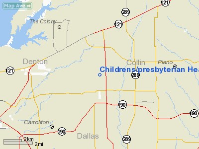
Childrens/presbyterian Health Ctr Of N Tx Heliport |
Location & QuickFacts
| FAA Information Effective: | 2008-09-25 |
| Airport Identifier: | 35TA |
| Airport Status: | Operational |
| Longitude/Latitude: | 096-50-14.0060W/33-02-36.4360N
-96.837224/33.043454 (Estimated) |
| Elevation: | 669 ft / 203.91 m (Estimated) |
| Land: | 0 acres |
| From nearest city: | 3 nautical miles N of Plano, TX |
| Location: | Collin County, TX |
| Magnetic Variation: | 06E (1990) |
Owner & Manager
| Ownership: | Privately owned |
| Owner: | Children's Presbyterian
HEALTHCARE CENTER. |
| Address: | 6200 W. Parker Road
Plano, TX 75093 |
| Phone number: | 214-608-8000 |
| Manager: | B. Joe Gunn, President C.e.o. |
| Address: | 6200 W. Parker Road
Plano, TX 75093 |
| Phone number: | 214-608-8000 |
Airport Operations and Facilities
| Airport Use: | Private
MEDICAL. |
| Wind indicator: | Yes |
| Segmented Circle: | No |
| Control Tower: | No |
| Lighting Schedule: | DUSK-DAWN |
| Beacon Color: | Clear-Green-Yellow (heliport) |
| Sectional chart: | Dallas-ft Worth |
| Region: | ASW - Southwest |
| Boundary ARTCC: | ZFW - Fort Worth |
| Tie-in FSS: | FTW - Fort Worth |
| FSS on Airport: | No |
| FSS Phone: | 817-541-3474 |
| FSS Toll Free: | 1-800-WX-BRIEF |
Runway Information
Helipad H1
| Dimension: | 40 x 40 ft / 12.2 x 12.2 m |
| Surface: | CONC, |
| |
Runway H1 |
Runway |
| Traffic Pattern: | Left | Left |
|
Radio Navigation Aids
| ID |
Type |
Name |
Ch |
Freq |
Var |
Dist |
| PQF | NDB | Mesquite | | 248.00 | 06E | 21.0 nm |
| RBD | NDB | Redbird | | 287.00 | 06E | 22.1 nm |
| JUG | NDB | Jecca | | 388.00 | 06E | 27.3 nm |
| XQH | NDB | Cedar Hill | | 353.00 | 08E | 28.1 nm |
| LNC | NDB | Lancaster | | 239.00 | 06E | 28.6 nm |
| MII | NDB | Caddo Mills | | 316.00 | 06E | 29.7 nm |
| AVZ | NDB | Travis | | 260.00 | 06E | 34.2 nm |
| SYW | NDB | Cash | | 428.00 | 05E | 39.0 nm |
| GLE | NDB | Gainesville | | 330.00 | 06E | 44.5 nm |
| DNI | NDB | Denison | | 341.00 | 06E | 47.7 nm |
| HJM | NDB | Rayburn | | 415.00 | 06E | 47.7 nm |
| NFW | TACAN | Nas Jrb Fort Worth | 024X | | 07E | 34.5 nm |
| MJF | TACAN | Arvilla | 033X | | 05E | 39.1 nm |
| CVE | VOR/DME | Cowboy | 109X | 116.20 | 06E | 9.8 nm |
| TTT | VOR/DME | Maverick | 078X | 113.10 | 06E | 14.7 nm |
| FUZ | VORTAC | Ranger | 104X | 115.70 | 06E | 19.6 nm |
| BYP | VORTAC | Bonham | 093X | 114.60 | 06E | 42.4 nm |
| DAL | VOT | Dallas Love Field | | 113.30 | | 11.8 nm |
| FTW | VOT | Fort Worth Meacham | | 108.20 | | 29.6 nm |
Remarks
- (E111-1) OBSTN LGTS ARE INSTALLED ON BLDGS; PROPOSED OVERHEAD PLINES ARE MKD; AND PERIMETER & DIRECTIONAL LIGHTING ARE INSTALLED.
- PRVDD VFR; A LGTD WIND CONE IS MAINTAINED; A SAFETY BARRIER IS PLACED AROUND HEL; A HORIZONTAL SAFETY NET IS INSTALLED AROUND PERIMETER RETAINING WALLS; A WARNING SIGN IS PLACED NEAR ENTRANCE TO HEL;
Images and information placed above are from
http://www.airport-data.com/airport/35TA/
We thank them for the data!
| General Info
|
| Country |
United States
|
| State |
TEXAS
|
| FAA ID |
35TA
|
| Latitude |
33-02-36.436N
|
| Longitude |
096-50-14.006W
|
| Elevation |
669 feet
|
| Near City |
PLANO
|
We don't guarantee the information is fresh and accurate. The data may
be wrong or outdated.
For more up-to-date information please refer to other sources.
|
|


