 |
|
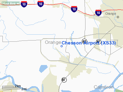
Location & QuickFacts
| FAA Information Effective: | 2008-09-25 |
| Airport Identifier: | XS33 |
| Airport Status: | Operational |
| Longitude/Latitude: | 093-51-52.6130W/30-03-44.7610N
-93.864615/30.062434 (Estimated) |
| Elevation: | 10 ft / 3.05 m (Estimated) |
| Land: | 0 acres |
| From nearest city: | 1 nautical miles S of Orangefield, TX |
| Location: | Orange County, TX |
| Magnetic Variation: | 05E (1985) |
Owner & Manager
| Ownership: | Privately owned |
| Owner: | Clyde Mitchell Chesson |
| Address: | Rt 10, Box 1464
Orange, TX 77630 |
| Phone number: | 713-735-3011 |
| Address: |
|
Airport Operations and Facilities
| Airport Use: | Private |
| Wind indicator: | Yes |
| Segmented Circle: | No |
| Control Tower: | No |
| Landing fee charge: | No |
| Sectional chart: | Houston |
| Region: | ASW - Southwest |
| Boundary ARTCC: | ZHU - Houston |
| Tie-in FSS: | CXO - Montgomery County |
| FSS on Airport: | No |
| FSS Toll Free: | 1-800-WX-BRIEF
FOR FP FILING CALL CXO FSS 1-800-833-5602. |
Runway Information
Runway 11/29
| Dimension: | 2600 x 43 ft / 792.5 x 13.1 m |
| Surface: | TURF, |
| |
Runway 11 |
Runway 29 |
| Traffic Pattern: | Left | Left |
|
Radio Navigation Aids
| ID |
Type |
Name |
Ch |
Freq |
Var |
Dist |
| ORG | NDB | Orange | | 211.00 | 05E | 3.7 nm |
| GDE | NDB | Goodhue | | 368.00 | 07E | 17.6 nm |
| UX | NDB | Sulfy | | 278.00 | 04E | 24.5 nm |
| HRD | NDB | Hardin County | | 524.00 | 04E | 26.4 nm |
| DQU | NDB | De Quincy | | 410.00 | 05E | 30.5 nm |
| CBC | NDB | Anahuac | | 413.00 | 05E | 45.1 nm |
| DR | NDB | Idder | | 385.00 | 04E | 49.7 nm |
| BPT | VOR/DME | Beaumont | 092X | 114.50 | 07E | 10.5 nm |
| SBI | VOR/DME | Sabine Pass | 101X | 115.40 | 07E | 24.3 nm |
| LCH | VORTAC | Lake Charles | 081X | 113.40 | 07E | 39.8 nm |
| DAS | VORTAC | Daisetta | 116X | 116.90 | 05E | 41.3 nm |
Remarks
- DRAIN DITCH BOTH SIDES OF RWY.
- PROVIDED SOUTH THR RWY END 29 IS DSPLCD TO PROVIDE A 20:1 APCH SLOPE.
Images and information placed above are from
http://www.airport-data.com/airport/XS33/
We thank them for the data!
| General Info
|
| Country |
United States
|
| State |
TEXAS
|
| FAA ID |
XS33
|
| Latitude |
30-03-44.761N
|
| Longitude |
093-51-52.613W
|
| Elevation |
10 feet
|
| Near City |
ORANGEFIELD
|
We don't guarantee the information is fresh and accurate. The data may
be wrong or outdated.
For more up-to-date information please refer to other sources.
|
|


