 |
|
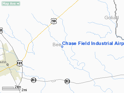
Chase Field Industrial Airport |
Location & QuickFacts
| FAA Information Effective: | 2008-09-25 |
| Airport Identifier: | 1XA2 |
| Airport Status: | Operational |
| Longitude/Latitude: | 097-39-06.0000W/28-26-06.0000N
-97.651667/28.435000 (Estimated) |
| Elevation: | 190 ft / 57.91 m (Estimated) |
| Land: | 0 acres |
| From nearest city: | 5 nautical miles SE of Beeville, TX |
| Location: | Bee County, TX |
| Magnetic Variation: | () |
Owner & Manager
| Ownership: | Publicly owned |
| Owner: | Chase Field Industrial Complex |
| Address: | 2922 Boyd Street
Beeville, TX 78102 |
| Phone number: | 361-358-2023 |
| Manager: | Joe B. Montez |
| Address: | 2922 Byrd Street, Po Box 1448
Beeville, TX 78102 |
| Phone number: | 361-358-2023 |
Airport Operations and Facilities
| Airport Use: | Private |
| Wind indicator: | Yes |
| Control Tower: | No |
| Sectional chart: | San Antonio |
| Region: | ASW - Southwest |
| Boundary ARTCC: | ZHU - Houston |
| Tie-in FSS: | SJT - San Angelo |
| FSS Toll Free: | 1-800-WX-BRIEF |
Runway Information
Runway 13L/31R
| Dimension: | 8000 x 200 ft / 2438.4 x 61.0 m |
| Surface: | ASPH-CONC, |
| |
Runway 13L |
Runway 31R |
| Traffic Pattern: | Left | Left |
|
Runway 13R/31L
| Dimension: | 8000 x 200 ft / 2438.4 x 61.0 m |
| Surface: | ASPH-CONC, |
| |
Runway 13R |
Runway 31L |
| Traffic Pattern: | Left | Left |
|
Runway 17/35
| Dimension: | 8000 x 200 ft / 2438.4 x 61.0 m |
| Surface: | ASPH-CONC, |
| |
Runway 17 |
Runway 35 |
| Traffic Pattern: | Left | Left |
|
Radio Navigation Aids
| ID |
Type |
Name |
Ch |
Freq |
Var |
Dist |
| BEA | NDB | Beeville | | 284.00 | 07E | 8.6 nm |
| MNO | NDB | Mellon Ranch | | 375.00 | 06E | 25.4 nm |
| RKP | NDB | Rockport | | 391.00 | 06E | 38.1 nm |
| NOG | TACAN | Orange Grove | 063X | | 09E | 38.5 nm |
| ALI | VOR | Alice | | 114.50 | 06E | 46.2 nm |
| VCT | VOR/DME | Victoria | 027X | 109.00 | 06E | 45.2 nm |
| THX | VORTAC | Three Rivers | 051X | 111.40 | 08E | 26.7 nm |
| CRP | VORTAC | Corpus Christi | 102X | 115.50 | 09E | 33.8 nm |
| NGP | VORTAC | Truax | 087X | 114.00 | 06E | 48.8 nm |
Images and information placed above are from
http://www.airport-data.com/airport/1XA2/
We thank them for the data!
| General Info
|
| Country |
United States
|
| State |
TEXAS
|
| FAA ID |
1XA2
|
| Latitude |
28.435000
28° 26' 06.00" N
|
| Longitude |
-97.651667
097° 39' 06.00" W
|
| Elevation |
190 feet
58 meters
|
| Magnetic Variation |
005° E (08/06)
|
| Operating Agency |
PRIVATE
|
We don't guarantee the information is fresh and accurate. The data may
be wrong or outdated.
For more up-to-date information please refer to other sources.
|
|


