 |
|
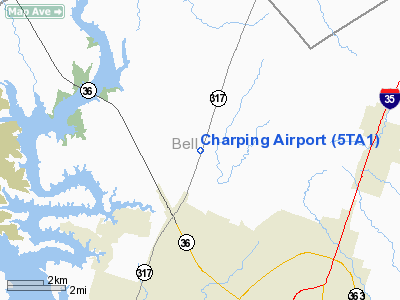
Location & QuickFacts
| FAA Information Effective: | 2008-09-25 |
| Airport Identifier: | 5TA1 |
| Airport Status: | Operational |
| Longitude/Latitude: | 097-24-26.0310W/31-11-36.6300N
-97.407231/31.193508 (Estimated) |
| Elevation: | 683 ft / 208.18 m (Estimated) |
| Land: | 0 acres |
| From nearest city: | 6 nautical miles N of Temple, TX |
| Location: | Bell County, TX |
| Magnetic Variation: | 07E (1985) |
Owner & Manager
| Ownership: | Privately owned |
| Owner: | Sandra Charping |
| Address: | Po Box 1229
Temple, TX 76501 |
| Phone number: | 817-939-8886 |
| Manager: | Sandra Charping |
| Address: | Po Box 1229
Temple, TX 76501 |
| Phone number: | 817-939-8886 |
Airport Operations and Facilities
| Airport Use: | Private |
| Wind indicator: | Yes |
| Segmented Circle: | No |
| Control Tower: | No |
| Landing fee charge: | No |
| Sectional chart: | San Antonio |
| Region: | ASW - Southwest |
| Boundary ARTCC: | ZHU - Houston |
| Tie-in FSS: | SJT - San Angelo |
| FSS on Airport: | No |
| FSS Toll Free: | 1-800-WX-BRIEF |
Runway Information
Runway 01/19
| Dimension: | 2200 x 60 ft / 670.6 x 18.3 m |
| Surface: | TURF, |
| |
Runway 01 |
Runway 19 |
| Traffic Pattern: | Left | Left |
| Obstruction: | 25 ft plines, 200.0 ft from runway | |
|
Radio Navigation Aids
| ID |
Type |
Name |
Ch |
Freq |
Var |
Dist |
| HLR | NDB | Hood | | 347.00 | 07E | 16.1 nm |
| IL | NDB | Iresh | | 278.00 | 07E | 18.5 nm |
| GR | NDB | Starn | | 323.00 | 07E | 24.3 nm |
| ROB | NDB | Robinson | | 400.00 | 07E | 25.5 nm |
| GUO | NDB | Georgetown | | 332.00 | 06E | 33.7 nm |
| MNZ | NDB | Hamilton | | 251.00 | 07E | 45.8 nm |
| TPL | VOR/DME | Temple | 041X | 110.40 | 09E | 1.3 nm |
| GRK | VOR/DME | Gray | 055X | 111.80 | 07E | 23.0 nm |
| GNL | VOR/DME | Groesbeck | 025X | 108.80 | 05E | 49.8 nm |
| ACT | VORTAC | Waco | 100X | 115.30 | 09E | 29.1 nm |
| LZZ | VORTAC | Lampasas | 072X | 112.50 | 08E | 37.8 nm |
| CWK | VORTAC | Centex | 075X | 112.80 | 06E | 49.4 nm |
Remarks
- VFR OPNS ONLY; PRVDD APCH SLOPES TO LNDG ARE MAINTD IAW PART 77 OF FAR.
Images and information placed above are from
http://www.airport-data.com/airport/5TA1/
We thank them for the data!
| General Info
|
| Country |
United States
|
| State |
TEXAS
|
| FAA ID |
5TA1
|
| Latitude |
31-11-36.630N
|
| Longitude |
097-24-26.031W
|
| Elevation |
683 feet
|
| Near City |
TEMPLE
|
We don't guarantee the information is fresh and accurate. The data may
be wrong or outdated.
For more up-to-date information please refer to other sources.
|
|


