 |
|
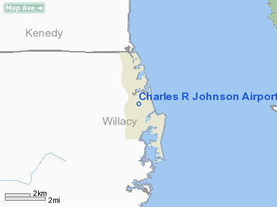
Charles R Johnson Airport |
Location & QuickFacts
| FAA Information Effective: | 2008-09-25 |
| Airport Identifier: | T05 |
| Airport Status: | Operational |
| Longitude/Latitude: | 097-26-15.9320W/26-33-46.2360N
-97.437759/26.562843 (Estimated) |
| Elevation: | 10 ft / 3.05 m (Estimated) |
| Land: | 132 acres |
| From nearest city: | 1 nautical miles NW of Port Mansfield, TX |
| Location: | Willacy County, TX |
| Magnetic Variation: | 07E (1985) |
Owner & Manager
| Ownership: | Publicly owned |
| Owner: | Willacy County Nav Dist |
| Address: | 400 W Hidalgo, Ste 200
Raymondville, TX 78580 |
| Phone number: | 956-689-3332 |
| Manager: | Frank Vasquez |
| Address: | Port Supt Office
Port Mansfield, TX 78598 |
| Phone number: | 956-944-2325 |
Airport Operations and Facilities
| Airport Use: | Open to public |
| Wind indicator: | Yes |
| Segmented Circle: | Yes |
| Control Tower: | No |
| Lighting Schedule: | DUSK-DAWN
MIRL RY 12/30 PRESET LOW INTST; TO INCR INTST ACTVT - CTAF. |
| Beacon Color: | Clear-Green (lighted land airport) |
| Sectional chart: | Brownsville |
| Region: | ASW - Southwest |
| Boundary ARTCC: | ZHU - Houston |
| Tie-in FSS: | SJT - San Angelo |
| FSS on Airport: | No |
| FSS Toll Free: | 1-800-WX-BRIEF |
| NOTAMs Facility: | SJT (NOTAM-d service avaliable) |
| Federal Agreements: | GY |
Airport Communications
Airport Services
| Fuel available: | 100LLA
FOR FUEL CALL 956-944-2325/2233 DURG NORMAL BUSINESS HRS ON PHONE LCTD IN BOX AT SE EDGE OF APRON. |
| Airframe Repair: | NONE |
| Power Plant Repair: | NONE |
| Bottled Oxygen: | NONE |
| Bulk Oxygen: | NONE |
Runway Information
Runway 12/30
| Dimension: | 3200 x 50 ft / 975.4 x 15.2 m |
| Surface: | ASPH, Good Condition
GRASS ENCROACHING PAVEMENT EDGES. |
| Weight Limit: | Single wheel: 21000 lbs. |
| Edge Lights: | Medium |
| |
Runway 12 |
Runway 30 |
| Traffic Pattern: | Left | Left |
| Markings: | Non-precision instrument, Good Condition | Non-precision instrument, Good Condition |
| Obstruction: | 30 ft pline, 1460.0 ft from runway, 42:1 slope to clear | 30 ft pline, 1250.0 ft from runway, 34:1 slope to clear |
|
Radio Navigation Aids
| ID |
Type |
Name |
Ch |
Freq |
Var |
Dist |
| HRL | VOR/DME | Harlingen | 029X | 109.20 | 05E | 23.1 nm |
| MAM | VOR/DME | Matamoros | 090X | 114.30 | 07E | 47.8 nm |
| MFE | VOR/DME | Mc Allen | 119X | 117.20 | 09E | 49.2 nm |
| BRO | VORTAC | Brownsville | 110X | 116.30 | 09E | 38.5 nm |
Remarks
Images and information placed above are from
http://www.airport-data.com/airport/T05/
We thank them for the data!
| General Info
|
| Country |
United States
|
| State |
TEXAS
|
| FAA ID |
T05
|
| Latitude |
26-33-46.236N
|
| Longitude |
097-26-15.932W
|
| Elevation |
10 feet
|
| Near City |
PORT MANSFIELD
|
We don't guarantee the information is fresh and accurate. The data may
be wrong or outdated.
For more up-to-date information please refer to other sources.
|
|


