 |
|
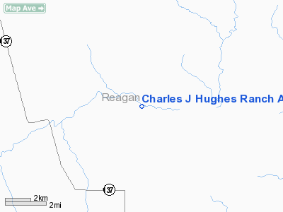
Charles J Hughes Ranch Airport |
Location & QuickFacts
| FAA Information Effective: | 2008-09-25 |
| Airport Identifier: | 74XS |
| Airport Status: | Operational |
| Longitude/Latitude: | 101-28-53.4200W/31-25-07.5280N
-101.481506/31.418758 (Estimated) |
| Elevation: | 2520 ft / 768.10 m (Estimated) |
| Land: | 0 acres |
| From nearest city: | 14 nautical miles N of Big Lake, TX |
| Location: | Reagan County, TX |
| Magnetic Variation: | 08E (1985) |
Owner & Manager
| Ownership: | Privately owned |
| Owner: | Charles J. Hughes |
| Address: | 1104 W. Beauregard
San Angelo, TX 76901-4114 |
| Phone number: | 915-655-5167 |
| Manager: | Charles J. Hughes |
| Address: | 1104 W. Beauregard
San Angelo, TX 76901-4114 |
| Phone number: | 915-655-5167 |
Airport Operations and Facilities
| Airport Use: | Private |
| Wind indicator: | Yes |
| Segmented Circle: | No |
| Control Tower: | No |
| Landing fee charge: | No |
| Sectional chart: | San Antonio |
| Region: | ASW - Southwest |
| Boundary ARTCC: | ZFW - Fort Worth |
| Tie-in FSS: | SJT - San Angelo |
| FSS on Airport: | No |
| FSS Toll Free: | 1-800-WX-BRIEF |
Runway Information
Runway 16/34
| Dimension: | 4700 x 50 ft / 1432.6 x 15.2 m |
| Surface: | TURF, |
| |
Runway 16 |
Runway 34 |
| Traffic Pattern: | Left | Left |
|
Radio Navigation Aids
| ID |
Type |
Name |
Ch |
Freq |
Var |
Dist |
| MAF | VOT | Midland International | | 108.20 | | 48.5 nm |
Images and information placed above are from
http://www.airport-data.com/airport/74XS/
We thank them for the data!
| General Info
|
| Country |
United States
|
| State |
TEXAS
|
| FAA ID |
74XS
|
| Latitude |
31-25-07.528N
|
| Longitude |
101-28-53.420W
|
| Elevation |
2520 feet
|
| Near City |
BIG LAKE
|
We don't guarantee the information is fresh and accurate. The data may
be wrong or outdated.
For more up-to-date information please refer to other sources.
|
|


