 |
|
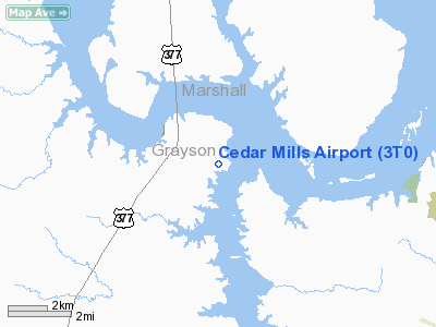
Location & QuickFacts
| FAA Information Effective: | 2008-09-25 |
| Airport Identifier: | 3T0 |
| Airport Status: | Operational |
| Longitude/Latitude: | 096-48-36.2483W/33-50-21.6459N
-96.810069/33.839346 (Estimated) |
| Elevation: | 640 ft / 195.07 m (Estimated) |
| Land: | 15 acres |
| From nearest city: | 3 nautical miles N of Gordonville, TX |
| Location: | Grayson County, TX |
| Magnetic Variation: | 06E (1995) |
Owner & Manager
| Ownership: | Privately owned |
| Owner: | Cedar Mills Marwa |
| Address: | 500 Harbour View
Gordonville, TX 76245 |
| Phone number: | 903-523-4222 |
| Manager: | Rich Worstell |
| Address: | 500 Harbour View
Gordonville, TX 76245 |
| Phone number: | 903-523-4222 |
Airport Operations and Facilities
| Airport Use: | Open to public |
| Wind indicator: | Yes |
| Segmented Circle: | Yes |
| Control Tower: | No |
| Sectional chart: | Dallas-ft Worth |
| Region: | ASW - Southwest |
| Boundary ARTCC: | ZFW - Fort Worth |
| Tie-in FSS: | FTW - Fort Worth |
| FSS on Airport: | No |
| FSS Phone: | 817-541-3474 |
| FSS Toll Free: | 1-800-WX-BRIEF |
| NOTAMs Facility: | FTW (NOTAM-d service avaliable) |
Airport Communications
Airport Services
Runway Information
Runway 07/25
| Dimension: | 3000 x 60 ft / 914.4 x 18.3 m |
| Surface: | TURF, |
| |
Runway 07 |
Runway 25 |
| Longitude: | 096-48-54.0000W | 096-48-18.6000W |
| Latitude: | 33-50-20.7700N | 33-50-23.5534N |
| Traffic Pattern: | Left | Left |
| Obstruction: | 15 ft trees, 355.0 ft from runway, 23:1 slope to clear | , 50:1 slope to clear |
|
Radio Navigation Aids
| ID |
Type |
Name |
Ch |
Freq |
Var |
Dist |
| DNI | NDB | Denison | | 341.00 | 06E | 7.1 nm |
| GLE | NDB | Gainesville | | 330.00 | 06E | 20.7 nm |
| DUA | NDB | Durant | | 359.00 | 05E | 21.4 nm |
| AUV | NDB | Arbuckle | | 284.00 | 07E | 24.4 nm |
| HJM | NDB | Rayburn | | 415.00 | 06E | 34.5 nm |
| URH | VOR/DME | Texoma | 090X | 114.30 | 05E | 21.8 nm |
| ADM | VORTAC | Ardmore | 114X | 116.70 | 06E | 28.6 nm |
| BYP | VORTAC | Bonham | 093X | 114.60 | 06E | 34.0 nm |
Images and information placed above are from
http://www.airport-data.com/airport/3T0/
We thank them for the data!
| General Info
|
| Country |
United States
|
| State |
TEXAS
|
| FAA ID |
3T0
|
| Latitude |
33-50-24.000N
|
| Longitude |
096-48-42.000W
|
| Elevation |
640 feet
|
| Near City |
GORDONVILLE
|
We don't guarantee the information is fresh and accurate. The data may
be wrong or outdated.
For more up-to-date information please refer to other sources.
|
|


