 |
|
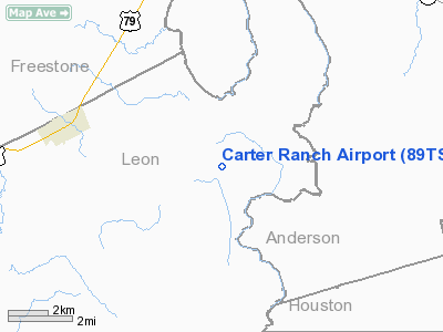
Location & QuickFacts
| FAA Information Effective: | 2008-09-25 |
| Airport Identifier: | 89TS |
| Airport Status: | Operational |
| Longitude/Latitude: | 095-45-59.8450W/31-34-00.6290N
-95.766624/31.566841 (Estimated) |
| Elevation: | 215 ft / 65.53 m (Estimated) |
| Land: | 0 acres |
| From nearest city: | 4 nautical miles E of Oakwood, TX |
| Location: | Leon County, TX |
| Magnetic Variation: | 06E (1985) |
Owner & Manager
| Ownership: | Privately owned |
| Owner: | Ben J. Fortson |
| Address: | 3550 N. Lincoln Ave.
Ft. Worth, TX 76106 |
| Phone number: | 817-335-5641 |
| Manager: | Ron Carron |
| Address: | 3550 N. Lincoln
Ft Worth, TX 76106 |
| Phone number: | 817-625-9808 |
Airport Operations and Facilities
| Airport Use: | Private |
| Segmented Circle: | No |
| Control Tower: | No |
| Sectional chart: | Houston |
| Region: | ASW - Southwest |
| Boundary ARTCC: | ZFW - Fort Worth |
| Tie-in FSS: | CXO - Montgomery County |
| FSS Toll Free: | 1-800-WX-BRIEF |
Runway Information
Runway 18/36
| Dimension: | 5200 x 75 ft / 1585.0 x 22.9 m |
| Surface: | ASPH-CONC, |
| |
Runway 18 |
Runway 36 |
| Traffic Pattern: | Left | Left |
|
Radio Navigation Aids
| ID |
Type |
Name |
Ch |
Freq |
Var |
Dist |
| PSN | NDB | Palestine | | 375.00 | 04E | 13.3 nm |
| PYF | NDB | Pyramid | | 418.00 | 06E | 28.3 nm |
| LIQ | NDB | Lochridge Ranch | | 335.00 | 09E | 28.3 nm |
| CSZ | NDB | Crossroads | | 215.00 | 08E | 31.4 nm |
| JSO | NDB | Cherokee County | | 263.00 | 05E | 33.6 nm |
| AHX | NDB | Athens | | 269.00 | 06E | 35.8 nm |
| LXY | NDB | Mexia | | 329.00 | 07E | 38.4 nm |
| CRS | NDB | Corsicana | | 396.00 | 06E | 42.4 nm |
| CGQ | NDB | Powell | | 344.00 | 06E | 45.1 nm |
| FZT | VOR/DME | Frankston | 051X | 111.40 | 06E | 32.8 nm |
| GNL | VOR/DME | Groesbeck | 025X | 108.80 | 05E | 40.1 nm |
| LOA | VORTAC | Leona | 045X | 110.80 | 08E | 28.6 nm |
| CQY | VORTAC | Cedar Creek | 095X | 114.80 | 06E | 43.8 nm |
Images and information placed above are from
http://www.airport-data.com/airport/89TS/
We thank them for the data!
| General Info
|
| Country |
United States
|
| State |
TEXAS
|
| FAA ID |
89TS
|
| Latitude |
31-34-00.629N
|
| Longitude |
095-45-59.845W
|
| Elevation |
215 feet
|
| Near City |
OAKWOOD
|
We don't guarantee the information is fresh and accurate. The data may
be wrong or outdated.
For more up-to-date information please refer to other sources.
|
|


