 |
|
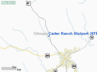
Carter Ranch Stolport Airport |
Location & QuickFacts
| FAA Information Effective: | 2008-09-25 |
| Airport Identifier: | 8TE7 |
| Airport Status: | Operational |
| Longitude/Latitude: | 098-54-46.1500W/30-19-14.7160N
-98.912819/30.320754 (Estimated) |
| Elevation: | 1840 ft / 560.83 m (Estimated) |
| Land: | 0 acres |
| From nearest city: | 3 nautical miles NW of Fredericksburg, TX |
| Location: | Gillespie County, TX |
| Magnetic Variation: | 07E (1985) |
Owner & Manager
| Ownership: | Privately owned |
| Owner: | Robert B Carter |
| Address: | P.o. Box 324
Fredericksburg, TX 78624 |
| Phone number: | 512-997-2455 |
| Address: |
|
Airport Operations and Facilities
| Airport Use: | Private |
| Wind indicator: | Yes |
| Segmented Circle: | No |
| Control Tower: | No |
| Landing fee charge: | No |
| Sectional chart: | San Antonio |
| Region: | ASW - Southwest |
| Boundary ARTCC: | ZHU - Houston |
| Tie-in FSS: | SJT - San Angelo |
| FSS on Airport: | No |
| FSS Toll Free: | 1-800-WX-BRIEF |
Runway Information
Runway 17/35
| Dimension: | 1700 x 30 ft / 518.2 x 9.1 m |
| Surface: | GRVL, |
| |
Runway 17 |
Runway 35 |
| Traffic Pattern: | Left | Left |
| Obstruction: | 7 ft fence | 50 ft trees, 0.0 ft from runway |
|
Radio Navigation Aids
| ID |
Type |
Name |
Ch |
Freq |
Var |
Dist |
| ER | NDB | Shein | | 263.00 | 08E | 24.9 nm |
| MFS | NDB | Horseshoe Bay Resort | | 403.00 | 07E | 31.2 nm |
| BMQ | NDB | Burnet | | 341.00 | 07E | 43.2 nm |
| STV | VORTAC | Stonewall | 085X | 113.80 | 08E | 12.7 nm |
| CSI | VORTAC | Center Point | 122X | 117.50 | 08E | 28.6 nm |
| LLO | VORTAC | Llano | 019X | 108.20 | 08E | 29.3 nm |
| SAT | VORTAC | San Antonio | 115X | 116.80 | 08E | 47.0 nm |
| JCT | VORTAC | Junction | 107X | 116.00 | 08E | 49.8 nm |
Remarks
- VFR OPERATIONS & PRIVATE USE ONLY.
Images and information placed above are from
http://www.airport-data.com/airport/8TE7/
We thank them for the data!
| General Info
|
| Country |
United States
|
| State |
TEXAS
|
| FAA ID |
8TE7
|
| Latitude |
30-19-14.716N
|
| Longitude |
098-54-46.150W
|
| Elevation |
1840 feet
|
| Near City |
FREDERICKSBURG
|
We don't guarantee the information is fresh and accurate. The data may
be wrong or outdated.
For more up-to-date information please refer to other sources.
|
|


