 |
|
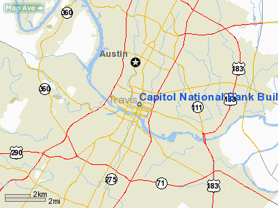
Capitol National Bank Building Heliport |
Location & QuickFacts
| FAA Information Effective: | 2008-09-25 |
| Airport Identifier: | 04TA |
| Airport Status: | Operational |
| Longitude/Latitude: | 097-44-41.0190W/30-16-15.7500N
-97.744727/30.271042 (Estimated) |
| Elevation: | 540 ft / 164.59 m (Estimated) |
| Land: | 0 acres |
| From nearest city: | 0 nautical miles N of Austin, TX |
| Location: | Travis County, TX |
| Magnetic Variation: | 07E (1985) |
Owner & Manager
| Ownership: | Privately owned |
| Owner: | Lumbermen's Investment Corp |
| Address: | Po Box 40
Austin, TX 78767 |
| Phone number: | 512-477-6561 |
| Manager: | Mike Shorter |
| Address: | Po Box 40
Austin, TX 78767 |
| Phone number: | 512-477-6561 |
Airport Operations and Facilities
| Airport Use: | Private |
| Wind indicator: | Yes |
| Segmented Circle: | No |
| Control Tower: | No |
| Lighting Schedule: | PHONE REQ
FOR PERIMETER LGTS CALL 512-477-6561. |
| Landing fee charge: | No |
| Sectional chart: | San Antonio |
| Region: | ASW - Southwest |
| Boundary ARTCC: | ZHU - Houston |
| Tie-in FSS: | SJT - San Angelo |
| FSS on Airport: | No |
| FSS Toll Free: | 1-800-WX-BRIEF |
Airport Communications
Runway Information
Helipad H1
| Dimension: | 60 x 40 ft / 18.3 x 12.2 m |
| Surface: | CONC, |
| |
Runway H1 |
Runway |
| Traffic Pattern: | Left | Left |
|
Radio Navigation Aids
| ID |
Type |
Name |
Ch |
Freq |
Var |
Dist |
| GUO | NDB | Georgetown | | 332.00 | 06E | 25.1 nm |
| MFS | NDB | Horseshoe Bay Resort | | 403.00 | 07E | 35.2 nm |
| BMQ | NDB | Burnet | | 341.00 | 07E | 38.0 nm |
| GYB | NDB | Lee County | | 385.00 | 07E | 40.2 nm |
| IL | NDB | Iresh | | 278.00 | 07E | 45.3 nm |
| GRK | VOR/DME | Gray | 055X | 111.80 | 07E | 45.9 nm |
| CWK | VORTAC | Centex | 075X | 112.80 | 06E | 12.9 nm |
Images and information placed above are from
http://www.airport-data.com/airport/04TA/
We thank them for the data!
| General Info
|
| Country |
United States
|
| State |
TEXAS
|
| FAA ID |
04TA
|
| Latitude |
30-16-15.750N
|
| Longitude |
097-44-41.019W
|
| Elevation |
540 feet
|
| Near City |
AUSTIN
|
We don't guarantee the information is fresh and accurate. The data may
be wrong or outdated.
For more up-to-date information please refer to other sources.
|
|


