 |
|
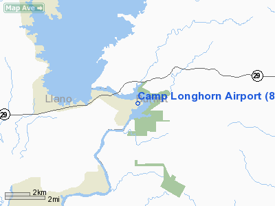
Location & QuickFacts
| FAA Information Effective: | 2008-09-25 |
| Airport Identifier: | 84TX |
| Airport Status: | Operational |
| Longitude/Latitude: | 098-22-43.1030W/30-44-28.6540N
-98.378640/30.741293 (Estimated) |
| Elevation: | 934 ft / 284.68 m (Estimated) |
| Land: | 0 acres |
| From nearest city: | 2 nautical miles E of Buchanan Dam, TX |
| Location: | Llano County, TX |
| Magnetic Variation: | 07E (1985) |
Owner & Manager
| Ownership: | Privately owned |
| Address: |
|
| Manager: | Robert S. Robertson |
| Address: | Camp Longhorn
Burnet, TX 78611 |
| Phone number: | 512-793-2811 |
Airport Operations and Facilities
| Airport Use: | Private |
| Wind indicator: | Yes |
| Segmented Circle: | No |
| Control Tower: | No |
| Sectional chart: | San Antonio |
| Region: | ASW - Southwest |
| Boundary ARTCC: | ZHU - Houston |
| Tie-in FSS: | SJT - San Angelo |
| FSS on Airport: | No |
| FSS Toll Free: | 1-800-WX-BRIEF |
Airport Services
| Airframe Repair: | NONE |
| Power Plant Repair: | NONE |
Runway Information
Runway 17/35
| Dimension: | 900 x 80 ft / 274.3 x 24.4 m |
| Surface: | TURF, |
| |
Runway 17 |
Runway 35 |
| Traffic Pattern: | Left | Left |
| Obstruction: | | 25 ft trees |
|
Radio Navigation Aids
| ID |
Type |
Name |
Ch |
Freq |
Var |
Dist |
| BMQ | NDB | Burnet | | 341.00 | 07E | 7.4 nm |
| MFS | NDB | Horseshoe Bay Resort | | 403.00 | 07E | 13.2 nm |
| GUO | NDB | Georgetown | | 332.00 | 06E | 36.3 nm |
| GR | NDB | Starn | | 323.00 | 07E | 36.4 nm |
| IL | NDB | Iresh | | 278.00 | 07E | 38.5 nm |
| HLR | NDB | Hood | | 347.00 | 07E | 41.6 nm |
| GRK | VOR/DME | Gray | 055X | 111.80 | 07E | 34.0 nm |
| LLO | VORTAC | Llano | 019X | 108.20 | 08E | 21.4 nm |
| LZZ | VORTAC | Lampasas | 072X | 112.50 | 08E | 29.4 nm |
| STV | VORTAC | Stonewall | 085X | 113.80 | 08E | 36.3 nm |
| CWK | VORTAC | Centex | 075X | 112.80 | 06E | 49.0 nm |
Remarks
- PLINE CROSSES LNDG STRIP.
Images and information placed above are from
http://www.airport-data.com/airport/84TX/
We thank them for the data!
| General Info
|
| Country |
United States
|
| State |
TEXAS
|
| FAA ID |
84TX
|
| Latitude |
30-44-28.654N
|
| Longitude |
098-22-43.103W
|
| Elevation |
934 feet
|
| Near City |
BUCHANAN DAM
|
We don't guarantee the information is fresh and accurate. The data may
be wrong or outdated.
For more up-to-date information please refer to other sources.
|
|


