 |
|
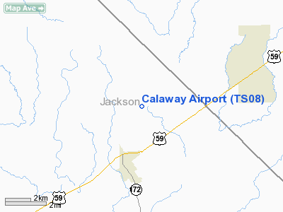
Location & QuickFacts
| FAA Information Effective: | 2008-09-25 |
| Airport Identifier: | TS08 |
| Airport Status: | Operational |
| Longitude/Latitude: | 096-30-00.8960W/29-05-00.9240N
-96.500249/29.083590 (Estimated) |
| Elevation: | 74 ft / 22.56 m (Estimated) |
| Land: | 17 acres |
| From nearest city: | 2 nautical miles NE of Ganado, TX |
| Location: | Jackson County, TX |
| Magnetic Variation: | 06E (1985) |
Owner & Manager
| Ownership: | Privately owned |
| Owner: | Roy Kuhlman/lee Kuhlman |
| Address: | Hcr 61, Box 69
Ganado, TX 77962 |
| Phone number: | 08/09/91 |
| Address: |
|
Airport Operations and Facilities
| Airport Use: | Private |
| Wind indicator: | Yes |
| Segmented Circle: | No |
| Control Tower: | No |
| Landing fee charge: | No |
| Sectional chart: | Houston |
| Region: | ASW - Southwest |
| Boundary ARTCC: | ZHU - Houston |
| Tie-in FSS: | CXO - Montgomery County |
| FSS on Airport: | No |
| FSS Toll Free: | 1-800-WX-BRIEF
FOR FP FILING CALL CXO FSS 1-800-833-5602. |
Airport Services
| Airframe Repair: | NONE |
| Power Plant Repair: | NONE |
Runway Information
Runway 17L/35R
| Dimension: | 2000 x 30 ft / 609.6 x 9.1 m |
| Surface: | CONC, |
| |
Runway 17L |
Runway 35R |
| Traffic Pattern: | Left | Left |
|
Runway 17R/35L
| Dimension: | 5000 x 75 ft / 1524.0 x 22.9 m |
| Surface: | TURF, |
| |
Runway 17R |
Runway 35L |
| Traffic Pattern: | Left | Left |
|
Radio Navigation Aids
| ID |
Type |
Name |
Ch |
Freq |
Var |
Dist |
| ARM | NDB | Wharton | | 245.00 | 06E | 21.0 nm |
| PKV | NDB | Port Lavaca | | 515.00 | 05E | 27.7 nm |
| BYY | NDB | Bay City | | 344.00 | 06E | 34.4 nm |
| OKT | NDB | Yoakum | | 350.00 | 06E | 36.2 nm |
| VCT | VOR/DME | Victoria | 027X | 109.00 | 06E | 27.5 nm |
| ELA | VOR/DME | Eagle Lake | 111X | 116.40 | 08E | 36.1 nm |
| PSX | VORTAC | Palacios | 120X | 117.30 | 08E | 21.7 nm |
Remarks
- DRAINAGE DITCH ON SOUTH END, AND ON WEST SIDE OF 17R/35L.
- MAY BE EXEMPT UNDER THE GRANDFATHER CLAUSE.
Images and information placed above are from
http://www.airport-data.com/airport/TS08/
We thank them for the data!
| General Info
|
| Country |
United States
|
| State |
TEXAS
|
| FAA ID |
TS08
|
| Latitude |
29-05-00.924N
|
| Longitude |
096-30-00.896W
|
| Elevation |
74 feet
|
| Near City |
GANADO
|
We don't guarantee the information is fresh and accurate. The data may
be wrong or outdated.
For more up-to-date information please refer to other sources.
|
|


