 |
|
Location & QuickFacts
| FAA Information Effective: | 2008-09-25 |
| Airport Identifier: | TS20 |
| Airport Status: | Operational |
| Longitude/Latitude: | 099-11-37.2640W/33-31-56.3460N
-99.193684/33.532318 (Estimated) |
| Elevation: | 1365 ft / 416.05 m (Estimated) |
| Land: | 5 acres |
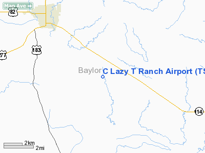
| From nearest city: | 5 nautical miles SE of Seymour, TX |
| Location: | Baylor County, TX |
| Magnetic Variation: | 08E (1990) |
Owner & Manager
| Ownership: | Privately owned |
| Owner: | C Lazy T Ranch |
| Address: | 3535 West 7th Street
Fort Worth, TX 76107 |
| Phone number: | 817-737-3103 |
| Manager: | J. C. Llewelllyn, President |
| Address: | 3535 West 7th Street
Fort Worth, TX 76107 |
| Phone number: | 817-737-3103 |
Airport Operations and Facilities
| Airport Use: | Private |
| Wind indicator: | Yes |
| Segmented Circle: | No |
| Control Tower: | No |
| Sectional chart: | Dallas-ft Worth |
| Region: | ASW - Southwest |
| Boundary ARTCC: | ZFW - Fort Worth |
| Tie-in FSS: | FTW - Fort Worth |
| FSS on Airport: | No |
| FSS Phone: | 817-541-3474 |
| FSS Toll Free: | 1-800-WX-BRIEF |
Runway Information
Runway 14/32
| Dimension: | 2150 x 50 ft / 655.3 x 15.2 m |
| Surface: | TURF, |
| |
Runway 14 |
Runway 32 |
| Traffic Pattern: | Left | Left |
| Obstruction: | | 4 ft fence, 300.0 ft from runway |
|
Radio Navigation Aids
| ID |
Type |
Name |
Ch |
Freq |
Var |
Dist |
| ONY | NDB | Olney | | 272.00 | 07E | 21.8 nm |
| AKL | NDB | Haskell | | 407.00 | 08E | 33.5 nm |
| SKB | NDB | Scotland | | 344.00 | 08E | 38.6 nm |
| GHX | NDB | Graham | | 371.00 | 07E | 41.4 nm |
| VRT | NDB | Wilbarger | | 230.00 | 08E | 41.9 nm |
| TMV | NDB | Stamford | | 290.00 | 08E | 48.3 nm |
| BKD | NDB | Breckenridge | | 245.00 | 07E | 49.6 nm |
| SHP | TACAN | Sheppard | 045X | | 10E | 44.5 nm |
| SPS | VORTAC | Wichita Falls | 074X | 112.70 | 10E | 40.6 nm |
Images and information placed above are from
http://www.airport-data.com/airport/TS20/
We thank them for the data!
| General Info
|
| Country |
United States
|
| State |
TEXAS
|
| FAA ID |
TS20
|
| Latitude |
33-31-56.346N
|
| Longitude |
099-11-37.264W
|
| Elevation |
1365 feet
|
| Near City |
SEYMOUR
|
We don't guarantee the information is fresh and accurate. The data may
be wrong or outdated.
For more up-to-date information please refer to other sources.
|
|


