 |
|
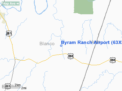
Location & QuickFacts
| FAA Information Effective: | 2008-09-25 |
| Airport Identifier: | 63XS |
| Airport Status: | Operational |
| Longitude/Latitude: | 098-17-19.0630W/30-13-26.7320N
-98.288629/30.224092 (Estimated) |
| Elevation: | 1120 ft / 341.38 m (Estimated) |
| Land: | 0 acres |
| From nearest city: | 4 nautical miles W of Henly, TX |
| Location: | Blanco County, TX |
| Magnetic Variation: | 07E (1985) |
Owner & Manager
| Ownership: | Privately owned |
| Owner: | John D. Byram |
| Address: | 510 S Congress Suite 400
Austin, TX 78704 |
| Phone number: | 512-474-4242 |
| Manager: | John D. Byram |
| Address: | 150 E. Riverside Dr/suite 500
Austin, TX 78704 |
| Phone number: | 512-472-6143 |
Airport Operations and Facilities
| Airport Use: | Private |
| Wind indicator: | Yes |
| Segmented Circle: | No |
| Control Tower: | No |
| Lighting Schedule: | PHONE REQ
FOR RWY LGTS CALL 512-444-1743. |
| Landing fee charge: | No |
| Sectional chart: | San Antonio |
| Region: | ASW - Southwest |
| Boundary ARTCC: | ZHU - Houston |
| Tie-in FSS: | SJT - San Angelo |
| FSS on Airport: | No |
| FSS Toll Free: | 1-800-WX-BRIEF |
Runway Information
Runway 17/35
| Dimension: | 4100 x 40 ft / 1249.7 x 12.2 m |
| Surface: | ASPH, |
| Edge Lights: | Medium |
| |
Runway 17 |
Runway 35 |
| Traffic Pattern: | Left | Left |
| VASI: | non-specific system | |
| Obstruction: | 50 ft trees, 100.0 ft from runway | 200 ft trees, 100.0 ft from runway |
|
Radio Navigation Aids
| ID |
Type |
Name |
Ch |
Freq |
Var |
Dist |
| MFS | NDB | Horseshoe Bay Resort | | 403.00 | 07E | 18.3 nm |
| BMQ | NDB | Burnet | | 341.00 | 07E | 31.1 nm |
| ER | NDB | Shein | | 263.00 | 08E | 41.8 nm |
| GUO | NDB | Georgetown | | 332.00 | 06E | 42.0 nm |
| DHK | TACAN | Randolph | 036X | | 09E | 41.3 nm |
| STV | VORTAC | Stonewall | 085X | 113.80 | 08E | 21.7 nm |
| SAT | VORTAC | San Antonio | 115X | 116.80 | 08E | 36.0 nm |
| CWK | VORTAC | Centex | 075X | 112.80 | 06E | 40.5 nm |
| RND | VORTAC | Randolph | 70X | 112.30 | 09E | 42.4 nm |
| LLO | VORTAC | Llano | 019X | 108.20 | 08E | 43.0 nm |
| SAT | VOT | San Antonio Intl | | 110.40 | | 42.6 nm |
Remarks
- PRVDD A MNM 20:1 APCH SLOPE TO EACH RWY END MAINTD; VFR OPNS ONLY.
Images and information placed above are from
http://www.airport-data.com/airport/63XS/
We thank them for the data!
| General Info
|
| Country |
United States
|
| State |
TEXAS
|
| FAA ID |
63XS
|
| Latitude |
30-13-26.732N
|
| Longitude |
098-17-19.063W
|
| Elevation |
1120 feet
|
| Near City |
HENLY
|
We don't guarantee the information is fresh and accurate. The data may
be wrong or outdated.
For more up-to-date information please refer to other sources.
|
|


