 |
|
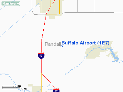
Location & QuickFacts
| FAA Information Effective: | 2008-09-25 |
| Airport Identifier: | 1E7 |
| Airport Status: | Operational |
| Longitude/Latitude: | 101-52-45.0000W/35-03-54.0000N
-101.879167/35.065000 (Estimated) |
| Elevation: | 3640 ft / 1109.47 m (Surveyed) |
| Land: | 40 acres |
| From nearest city: | 9 nautical miles S of Amarillo, TX |
| Location: | Randall County, TX |
| Magnetic Variation: | 09E (1985) |
Owner & Manager
| Ownership: | Privately owned |
| Owner: | Greg Dodson |
| Address: | 13990 Buffalo Airport Rd
Amarillo, TX 79118 |
| Phone number: | 806-622-1374 |
| Manager: | Greg Dodson |
| Address: | 13990 Buffalo Airport Rd
Amarillo, TX 79118 |
| Phone number: | 806-622-1374 |
Airport Operations and Facilities
| Airport Use: | Open to public |
| Wind indicator: | Yes |
| Segmented Circle: | No |
| Control Tower: | No |
| Lighting Schedule: | DUSK-0100
FOR ROTG BCN AFT 0100 CALL 806-622-1374. |
| Beacon Color: | Clear-Green (lighted land airport)
ROTG BCN OTS INDEFLY. |
| Landing fee charge: | No |
| Sectional chart: | Dallas-ft Worth |
| Region: | ASW - Southwest |
| Boundary ARTCC: | ZAB - Albuquerque |
| Tie-in FSS: | FTW - Fort Worth |
| FSS on Airport: | No |
| FSS Phone: | 817-541-3474 |
| FSS Toll Free: | 1-800-WX-BRIEF |
| NOTAMs Facility: | FTW (NOTAM-d service avaliable) |
Airport Communications
| CTAF: | 122.800 |
| Unicom: | 122.800 |
Airport Services
| Fuel available: | 100LLMOGAS |
| Airframe Repair: | MINOR |
| Power Plant Repair: | MINOR |
| Bottled Oxygen: | NONE |
| Bulk Oxygen: | NONE |
Runway Information
Runway 02/20
| Dimension: | 6200 x 150 ft / 1889.8 x 45.7 m |
| Surface: | TURF, Good Condition |
| Edge Lights: | Non-standard lighting system
NSTD LIRL; FIRST 3000 FT NORTH END OF RY LGTD. THLD LGTS AT NORTH END ONLY. |
| |
Runway 02 |
Runway 20 |
| Alignment: | 23 | 127 |
| Traffic Pattern: | Left | Right |
| Obstruction: | 4 ft fence | 15 ft road, 20.0 ft from runway, 1:1 slope to clear |
|
Runway 08/26
| Dimension: | 1600 x 102 ft / 487.7 x 31.1 m |
| Surface: | TURF, Good Condition |
| |
Runway 08 |
Runway 26 |
| Alignment: | 89 | 127 |
| Traffic Pattern: | Left | Left |
| Obstruction: | 37 ft pline, 208.0 ft from runway, 5:1 slope to clear | 5 ft sign, 0.0 ft from runway, 27 ft right of centerline |
|
Radio Navigation Aids
| ID |
Type |
Name |
Ch |
Freq |
Var |
Dist |
| AM | NDB | Pande | | 251.00 | 09E | 6.1 nm |
| HRX | NDB | Hereford | | 341.00 | 09E | 25.2 nm |
| DUX | NDB | Durrett | | 414.00 | 09E | 48.4 nm |
| PNH | VORTAC | Panhandle | 113X | 116.60 | 08E | 13.5 nm |
Remarks
- EXTENSIVE RADIO CONTROLLED MODEL ACFT ACTIVITY NORTH END OF ARPT.
- RY 02/20 LIRL OTS INDEFLY.
Images and information placed above are from
http://www.airport-data.com/airport/1E7/
We thank them for the data!
| General Info
|
| Country |
United States
|
| State |
TEXAS
|
| FAA ID |
1E7
|
| Latitude |
35-03-54.000N
|
| Longitude |
101-52-45.000W
|
| Elevation |
3640 feet
|
| Near City |
AMARILLO
|
We don't guarantee the information is fresh and accurate. The data may
be wrong or outdated.
For more up-to-date information please refer to other sources.
|
|


