 |
|
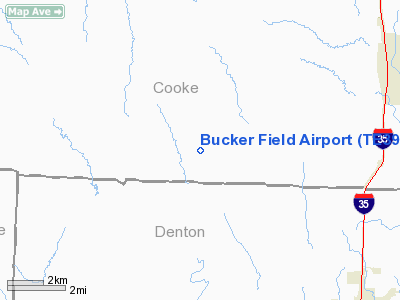
Location & QuickFacts
| FAA Information Effective: | 2008-09-25 |
| Airport Identifier: | TE39 |
| Airport Status: | Operational |
| Longitude/Latitude: | 097-16-24.0600W/33-26-35.4000N
-97.273350/33.443167 (Estimated) |
| Elevation: | 877 ft / 267.31 m (Estimated) |
| Land: | 34 acres |
| From nearest city: | 2 nautical miles SE of Era, TX |
| Location: | Cooke County, TX |
| Magnetic Variation: | 06E (1995) |
Owner & Manager
| Ownership: | Privately owned |
| Owner: | Jeff Rowland |
| Address: | Rt 4 Box 626
Gainesville, TX 76240-9501 |
| Phone number: | 817-726-3908 |
| Manager: | Jeff Rowland |
| Address: | Rt 4 Box 626
Gainesville, TX 76240-9501 |
| Phone number: | 817-726-3908 |
Airport Operations and Facilities
| Airport Use: | Private |
| Wind indicator: | Yes |
| Segmented Circle: | No |
| Control Tower: | No |
| Sectional chart: | Dallas-ft Worth |
| Region: | ASW - Southwest |
| Boundary ARTCC: | ZFW - Fort Worth |
| Tie-in FSS: | FTW - Fort Worth |
| FSS on Airport: | No |
| FSS Phone: | 817-541-3474 |
| FSS Toll Free: | 1-800-WX-BRIEF |
Runway Information
Runway 17/35
| Dimension: | 2100 x 75 ft / 640.1 x 22.9 m |
| Surface: | TURF, |
| |
Runway 17 |
Runway 35 |
| Traffic Pattern: | Left | Left |
| Displaced threshold: | 700.00 ft | 0.00 ft |
| Obstruction: | 30 ft pline, 10.0 ft from runway | |
|
Radio Navigation Aids
| ID |
Type |
Name |
Ch |
Freq |
Var |
Dist |
| GLE | NDB | Gainesville | | 330.00 | 06E | 17.0 nm |
| GMZ | NDB | Grindstone Mountain | | 356.00 | 07E | 26.9 nm |
| DNI | NDB | Denison | | 341.00 | 06E | 37.9 nm |
| AUV | NDB | Arbuckle | | 284.00 | 07E | 43.2 nm |
| NFW | TACAN | Nas Jrb Fort Worth | 024X | | 07E | 41.2 nm |
| TTT | VOR/DME | Maverick | 078X | 113.10 | 06E | 36.4 nm |
| CVE | VOR/DME | Cowboy | 109X | 116.20 | 06E | 38.1 nm |
| UKW | VORTAC | Bowie | 071X | 112.40 | 06E | 28.0 nm |
| FUZ | VORTAC | Ranger | 104X | 115.70 | 06E | 33.6 nm |
| ADM | VORTAC | Ardmore | 114X | 116.70 | 06E | 46.5 nm |
| FTW | VOT | Fort Worth Meacham | | 108.20 | | 37.8 nm |
| DAL | VOT | Dallas Love Field | | 113.30 | | 41.6 nm |
Images and information placed above are from
http://www.airport-data.com/airport/TE39/
We thank them for the data!
| General Info
|
| Country |
United States
|
| State |
TEXAS
|
| FAA ID |
TE74
|
| Latitude |
32-57-13.000N
|
| Longitude |
095-52-01.000W
|
| Elevation |
485 feet
|
| Near City |
POINT
|
We don't guarantee the information is fresh and accurate. The data may
be wrong or outdated.
For more up-to-date information please refer to other sources.
|
|


