 |
|
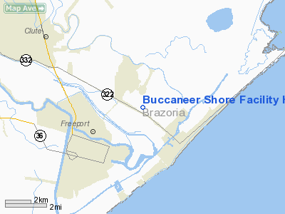
Buccaneer Shore Facility Heliport |
Location & QuickFacts
| FAA Information Effective: | 2008-09-25 |
| Airport Identifier: | 9TA6 |
| Airport Status: | Operational |
| Longitude/Latitude: | 095-19-02.7750W/28-58-36.8880N
-95.317438/28.976913 (Estimated) |
| Elevation: | 5 ft / 1.52 m (Estimated) |
| Land: | 0 acres |
| From nearest city: | 2 nautical miles NE of Freeport, TX |
| Location: | Brazoria County, TX |
| Magnetic Variation: | 06E (1985) |
Owner & Manager
| Ownership: | Privately owned |
| Owner: | Ivory Production Co. |
| Address: | 11 Greenway Plaza, Suite 1606
Houston, TX 77046 |
| Phone number: | 713-621-3993 |
| Manager: | Alvin Childs |
| Address: | 2384 East Hwy 332; Po Box 964
Freeport, TX 77541 |
| Phone number: | 409-233-8547 |
Airport Operations and Facilities
| Airport Use: | Private |
| Wind indicator: | Yes |
| Segmented Circle: | No |
| Control Tower: | No |
| Sectional chart: | Houston |
| Region: | ASW - Southwest |
| Boundary ARTCC: | ZHU - Houston |
| Tie-in FSS: | CXO - Montgomery County |
| FSS on Airport: | No |
| FSS Toll Free: | 1-800-WX-BRIEF
FOR FP FILING CALL CXO FSS 1-800-833-5602. |
Runway Information
Helipad H1
| Dimension: | 45 x 45 ft / 13.7 x 13.7 m |
| Surface: | ASPH, |
| |
Runway H1 |
Runway |
| Traffic Pattern: | Left | Left |
|
Radio Navigation Aids
| ID |
Type |
Name |
Ch |
Freq |
Var |
Dist |
| BYY | NDB | Bay City | | 344.00 | 06E | 28.5 nm |
| SYG | NDB | Sandy Point | | 402.00 | 05E | 32.6 nm |
| GLS | NDB | Galveston | | 206.00 | 08E | 36.4 nm |
| SGR | NDB | Hull | | 388.00 | 05E | 43.2 nm |
| JPA | NDB | Sanjac | | 347.00 | 05E | 43.5 nm |
| ARM | NDB | Wharton | | 245.00 | 06E | 46.9 nm |
| EFD | TACAN | Ellington | 031X | | 05E | 38.7 nm |
| HUB | VOR/DME | Hobby | 118X | 117.10 | 05E | 40.9 nm |
| MHF | VOR/DME | Trinity | 083X | 113.60 | 07E | 45.4 nm |
| VUH | VORTAC | Scholes | 077X | 113.00 | 06E | 29.4 nm |
| HOU | VOT | Houston Wm P Hobby | | 108.40 | | 40.2 nm |
Images and information placed above are from
http://www.airport-data.com/airport/9TA6/
We thank them for the data!
| General Info
|
| Country |
United States
|
| State |
TEXAS
|
| FAA ID |
9TA6
|
| Latitude |
28-58-36.888N
|
| Longitude |
095-19-02.775W
|
| Elevation |
5 feet
|
| Near City |
FREEPORT
|
We don't guarantee the information is fresh and accurate. The data may
be wrong or outdated.
For more up-to-date information please refer to other sources.
|
|


