 |
|
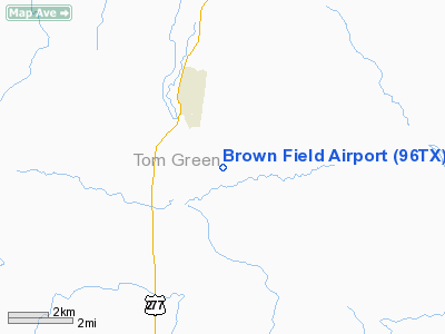
Location & QuickFacts
| FAA Information Effective: | 2008-09-25 |
| Airport Identifier: | 96TX |
| Airport Status: | Operational |
| Longitude/Latitude: | 100-28-35.3350W/31-09-55.6030N
-100.476482/31.165445 (Estimated) |
| Elevation: | 2125 ft / 647.70 m (Estimated) |
| Land: | 6 acres |
| From nearest city: | 2 nautical miles SE of Christoval, TX |
| Location: | Tom Green County, TX |
| Magnetic Variation: | 08E (1985) |
Owner & Manager
| Ownership: | Privately owned |
| Owner: | Dan F. Brown |
| Address: | Po Box 257
Christoval, TX 76935 |
| Phone number: | 915-255-2254 |
| Manager: | Dan F. Brown |
| Address: | Po Box 257
Christoval, TX 76935 |
| Phone number: | 915-255-2254 |
Airport Operations and Facilities
| Airport Use: | Private |
| Wind indicator: | Yes |
| Segmented Circle: | No |
| Control Tower: | No |
| Sectional chart: | San Antonio |
| Region: | ASW - Southwest |
| Boundary ARTCC: | ZFW - Fort Worth |
| Tie-in FSS: | SJT - San Angelo |
| FSS Toll Free: | 1-800-WX-BRIEF |
Runway Information
Runway N/S
| Dimension: | 3000 x 90 ft / 914.4 x 27.4 m |
| Surface: | TURF, |
| |
Runway N |
Runway S |
| Traffic Pattern: | Left | Left |
| Obstruction: | | 30 ft pline, 200.0 ft from runway |
|
Radio Navigation Aids
| ID |
Type |
Name |
Ch |
Freq |
Var |
Dist |
| SOA | NDB | Sonora | | 371.00 | 08E | 36.2 nm |
| UBC | NDB | Ballinger | | 239.00 | 08E | 40.3 nm |
| SJT | VORTAC | San Angelo | 098X | 115.10 | 10E | 12.6 nm |
| JCT | VORTAC | Junction | 107X | 116.00 | 08E | 48.2 nm |
Images and information placed above are from
http://www.airport-data.com/airport/96TX/
We thank them for the data!
| General Info
|
| Country |
United States
|
| State |
TEXAS
|
| FAA ID |
96TX
|
| Latitude |
31-09-55.603N
|
| Longitude |
100-28-35.335W
|
| Elevation |
2125 feet
|
| Near City |
CHRISTOVAL
|
We don't guarantee the information is fresh and accurate. The data may
be wrong or outdated.
For more up-to-date information please refer to other sources.
|
|


