 |
|
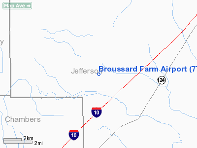
Location & QuickFacts
| FAA Information Effective: | 2008-09-25 |
| Airport Identifier: | 7TS7 |
| Airport Status: | Operational |
| Longitude/Latitude: | 094-20-20.6750W/29-54-39.7830N
-94.339076/29.911051 (Estimated) |
| Elevation: | 20 ft / 6.10 m (Estimated) |
| Land: | 0 acres |
| From nearest city: | 4 nautical miles W of Fannett, TX |
| Location: | Jefferson County, TX |
| Magnetic Variation: | 05E (1985) |
Owner & Manager
| Ownership: | Privately owned |
| Owner: | J.h. Broussard, Jr |
| Address: | P.o. Box 21
Nome, TX 77629 |
| Phone number: | 713-253-2459 |
| Manager: | J.h. Broussard, Jr |
| Address: | P.o. Box 21
Nome, TX 77629 |
| Phone number: | 713-253-2459 |
Airport Operations and Facilities
| Airport Use: | Private |
| Wind indicator: | No |
| Segmented Circle: | No |
| Control Tower: | No |
| Landing fee charge: | No |
| Sectional chart: | Houston |
| Region: | ASW - Southwest |
| Boundary ARTCC: | ZHU - Houston |
| Tie-in FSS: | CXO - Montgomery County |
| FSS on Airport: | No |
| FSS Toll Free: | 1-800-WX-BRIEF
FOR FP FILING CALL CXO FSS 1-800-833-5602. |
Runway Information
Runway 18/36
| Dimension: | 2300 x 90 ft / 701.0 x 27.4 m |
| Surface: | TURF, |
| |
Runway 18 |
Runway 36 |
| Traffic Pattern: | Left | Left |
|
Radio Navigation Aids
| ID |
Type |
Name |
Ch |
Freq |
Var |
Dist |
| GDE | NDB | Goodhue | | 368.00 | 07E | 11.9 nm |
| CBC | NDB | Anahuac | | 413.00 | 05E | 18.8 nm |
| HRD | NDB | Hardin County | | 524.00 | 04E | 26.0 nm |
| ORG | NDB | Orange | | 211.00 | 05E | 29.9 nm |
| JPA | NDB | Sanjac | | 347.00 | 05E | 40.8 nm |
| GLS | NDB | Galveston | | 206.00 | 08E | 41.0 nm |
| BVP | NDB | Nixin | | 326.00 | 05E | 45.9 nm |
| EFD | TACAN | Ellington | 031X | | 05E | 46.6 nm |
| BPT | VOR/DME | Beaumont | 092X | 114.50 | 07E | 16.9 nm |
| SBI | VOR/DME | Sabine Pass | 101X | 115.40 | 07E | 20.7 nm |
| MHF | VOR/DME | Trinity | 083X | 113.60 | 07E | 30.6 nm |
| DAS | VORTAC | Daisetta | 116X | 116.90 | 05E | 23.1 nm |
| VUH | VORTAC | Scholes | 077X | 113.00 | 06E | 47.4 nm |
Remarks
- OWNER REQUESTS FACILITY NOT BE CHARTED.
- PROVIDED VFR OPERATIONS ONLY.
Images and information placed above are from
http://www.airport-data.com/airport/7TS7/
We thank them for the data!
| General Info
|
| Country |
United States
|
| State |
TEXAS
|
| FAA ID |
7TS7
|
| Latitude |
29-54-39.783N
|
| Longitude |
094-20-20.675W
|
| Elevation |
20 feet
|
| Near City |
FANNETT
|
We don't guarantee the information is fresh and accurate. The data may
be wrong or outdated.
For more up-to-date information please refer to other sources.
|
|


