 |
|
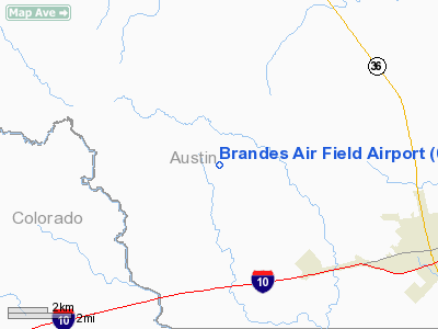
Brandes Air Field Airport |
Location & QuickFacts
| FAA Information Effective: | 2008-09-25 |
| Airport Identifier: | 05TA |
| Airport Status: | Operational |
| Longitude/Latitude: | 096-15-54.2800W/29-48-32.8700N
-96.265078/29.809131 (Estimated) |
| Elevation: | 276 ft / 84.12 m (Estimated) |
| Land: | 60 acres |
| From nearest city: | 7 nautical miles NW of Sealy, TX |
| Location: | Austin County, TX |
| Magnetic Variation: | 06E (1995) |
Owner & Manager
| Ownership: | Privately owned |
| Owner: | Jack W Brandes |
| Address: | Rt 1 Box 34b
Cat Spring, TX 78933 |
| Phone number: | 409-885-3084 |
| Manager: | Jack W Brandes |
| Address: | Rt 1 Box 34b
Cat Spring, TX 78933 |
| Phone number: | 409-865-3111 |
Airport Operations and Facilities
| Airport Use: | Private |
| Wind indicator: | Yes |
| Segmented Circle: | No |
| Control Tower: | No |
| Sectional chart: | Houston |
| Region: | ASW - Southwest |
| Boundary ARTCC: | ZHU - Houston |
| Tie-in FSS: | CXO - Montgomery County |
| FSS on Airport: | No |
| FSS Toll Free: | 1-800-WX-BRIEF |
Runway Information
Runway 17/35
| Dimension: | 1700 x 40 ft / 518.2 x 12.2 m |
| Surface: | TURF, Good Condition |
| |
Runway 17 |
Runway 35 |
| Traffic Pattern: | Left | Left |
| Displaced threshold: | 240.00 ft | 120.00 ft |
| Obstruction: | 12 ft trees | 6 ft fence |
|
Radio Navigation Aids
| ID |
Type |
Name |
Ch |
Freq |
Var |
Dist |
| BNH | NDB | Brenham | | 362.00 | 06E | 25.5 nm |
| LYD | NDB | Lakeside | | 249.00 | 05E | 30.6 nm |
| EYQ | NDB | Weiser | | 286.00 | 06E | 33.4 nm |
| SGR | NDB | Hull | | 388.00 | 05E | 33.5 nm |
| ARM | NDB | Wharton | | 245.00 | 06E | 33.8 nm |
| DWH | NDB | David Hooks | | 521.00 | 05E | 41.1 nm |
| GYB | NDB | Lee County | | 385.00 | 07E | 43.0 nm |
| SYG | NDB | Sandy Point | | 402.00 | 05E | 45.5 nm |
| ELA | VOR/DME | Eagle Lake | 111X | 116.40 | 08E | 9.2 nm |
| IDU | VORTAC | Industry | 039X | 110.20 | 08E | 17.8 nm |
| TNV | VORTAC | Navasota | 106X | 115.90 | 08E | 30.8 nm |
| CLL | VORTAC | College Station | 080X | 113.30 | 08E | 48.5 nm |
| IAH | VORTAC | Humble | 113X | 116.60 | 05E | 48.7 nm |
Images and information placed above are from
http://www.airport-data.com/airport/05TA/
We thank them for the data!
| General Info
|
| Country |
United States
|
| State |
TEXAS
|
| FAA ID |
05TA
|
| Latitude |
29-48-32.870N
|
| Longitude |
096-15-54.280W
|
| Elevation |
276 feet
|
| Near City |
SEALY
|
We don't guarantee the information is fresh and accurate. The data may
be wrong or outdated.
For more up-to-date information please refer to other sources.
|
|


