 |
|
Location & QuickFacts
| FAA Information Effective: | 2008-09-25 |
| Airport Identifier: | 88XS |
| Airport Status: | Operational |
| Longitude/Latitude: | 094-23-15.6810W/30-01-08.7730N
-94.387689/30.019104 (Estimated) |
| Elevation: | 35 ft / 10.67 m (Estimated) |
| Land: | 0 acres |
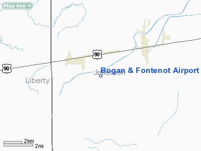
| From nearest city: | 3 nautical miles SE of Nome, TX |
| Location: | Jefferson County, TX |
| Magnetic Variation: | 05E (1985) |
Owner & Manager
| Ownership: | Privately owned |
| Owner: | J.r. Fontenot |
| Address: | Po Box 323
China, TX 77613 |
| Phone number: | 713-752-3011 |
| Manager: | J.r. Fontenot |
| Address: | Po Box 323
China, TX 77613 |
| Phone number: | 713-752-3011 |
Airport Operations and Facilities
| Airport Use: | Private |
| Wind indicator: | No |
| Segmented Circle: | No |
| Control Tower: | No |
| Landing fee charge: | No |
| Sectional chart: | Houston |
| Region: | ASW - Southwest |
| Boundary ARTCC: | ZHU - Houston |
| Tie-in FSS: | CXO - Montgomery County |
| FSS on Airport: | No |
| FSS Toll Free: | 1-800-WX-BRIEF |
Runway Information
Runway 17/35
| Dimension: | 2200 x 110 ft / 670.6 x 33.5 m |
| Surface: | TURF, |
| |
Runway 17 |
Runway 35 |
| Traffic Pattern: | Left | Left |
|
Radio Navigation Aids
| ID |
Type |
Name |
Ch |
Freq |
Var |
Dist |
| GDE | NDB | Goodhue | | 368.00 | 07E | 10.1 nm |
| HRD | NDB | Hardin County | | 524.00 | 04E | 20.2 nm |
| CBC | NDB | Anahuac | | 413.00 | 05E | 20.6 nm |
| ORG | NDB | Orange | | 211.00 | 05E | 31.0 nm |
| JPA | NDB | Sanjac | | 347.00 | 05E | 41.3 nm |
| BVP | NDB | Nixin | | 326.00 | 05E | 43.1 nm |
| GLS | NDB | Galveston | | 206.00 | 08E | 45.5 nm |
| EFD | TACAN | Ellington | 031X | | 05E | 47.3 nm |
| BPT | VOR/DME | Beaumont | 092X | 114.50 | 07E | 19.8 nm |
| SBI | VOR/DME | Sabine Pass | 101X | 115.40 | 07E | 27.0 nm |
| MHF | VOR/DME | Trinity | 083X | 113.60 | 07E | 34.1 nm |
| DAS | VORTAC | Daisetta | 116X | 116.90 | 05E | 16.9 nm |
Images and information placed above are from
http://www.airport-data.com/airport/88XS/
We thank them for the data!
| General Info
|
| Country |
United States
|
| State |
TEXAS
|
| FAA ID |
88XS
|
| Latitude |
30-01-08.773N
|
| Longitude |
094-23-15.681W
|
| Elevation |
35 feet
|
| Near City |
NOME
|
We don't guarantee the information is fresh and accurate. The data may
be wrong or outdated.
For more up-to-date information please refer to other sources.
|
|


