 |
|
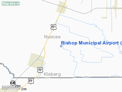
Location & QuickFacts
| FAA Information Effective: | 2008-09-25 |
| Airport Identifier: | 07R |
| Airport Status: | Operational |
| Longitude/Latitude: | 097-45-06.9850W/27-36-37.1150N
-97.751940/27.610310 (Estimated) |
| Elevation: | 55 ft / 16.76 m (Estimated) |
| Land: | 250 acres |
| From nearest city: | 3 nautical miles NE of Bishop, TX |
| Location: | Nueces County, TX |
| Magnetic Variation: | 07E (1985) |
Owner & Manager
| Ownership: | Publicly owned |
| Owner: | City Of Bishop |
| Address: | Po Box 356
Bishop, TX 78343 |
| Phone number: | 361-584-2567 |
| Manager: | Charlie Michalk
PRESIDENT OF THE AIRPORT ADVISORY BOARD. |
| Address: | Po Box 356
Bishop, TX 78343 |
| Phone number: | 361-516-6151 |
Airport Operations and Facilities
| Airport Use: | Open to public |
| Wind indicator: | Yes |
| Segmented Circle: | Yes |
| Control Tower: | No |
| Lighting Schedule: | DUSK-DAWN
ACTVT MIRL RY 15/33 - CTAF. |
| Beacon Color: | Clear-Green (lighted land airport) |
| Landing fee charge: | No |
| Sectional chart: | Brownsville |
| Region: | ASW - Southwest |
| Boundary ARTCC: | ZHU - Houston |
| Tie-in FSS: | SJT - San Angelo |
| FSS on Airport: | No |
| FSS Toll Free: | 1-800-WX-BRIEF |
| NOTAMs Facility: | SJT (NOTAM-d service avaliable) |
| Federal Agreements: | P |
Airport Communications
Airport Services
Runway Information
Runway 15/33
| Dimension: | 3200 x 50 ft / 975.4 x 15.2 m |
| Surface: | ASPH, Good Condition |
| Weight Limit: | Single wheel: 12500 lbs. |
| Edge Lights: | Medium |
| |
Runway 15 |
Runway 33 |
| Traffic Pattern: | Left | Left |
| Markings: | Basic, Good Condition | Basic, Good Condition |
| Obstruction: | 15 ft road, 519.0 ft from runway, 155 ft left of centerline, 21:1 slope to clear | 25 ft pline, 940.0 ft from runway, 185 ft left of centerline, 29:1 slope to clear |
|
Radio Navigation Aids
| ID |
Type |
Name |
Ch |
Freq |
Var |
Dist |
| TKB | NDB | Kleberg County | | 347.00 | 06E | 17.8 nm |
| BKS | NDB | Brooks County | | 353.00 | 06E | 31.3 nm |
| BEA | NDB | Beeville | | 284.00 | 07E | 45.6 nm |
| RKP | NDB | Rockport | | 391.00 | 06E | 47.3 nm |
| MNO | NDB | Mellon Ranch | | 375.00 | 06E | 49.6 nm |
| NQI | TACAN | Kingsville | 125X | | 09E | 7.3 nm |
| NOG | TACAN | Orange Grove | 063X | | 09E | 23.1 nm |
| ALI | VOR | Alice | | 114.50 | 06E | 16.3 nm |
| CRP | VORTAC | Corpus Christi | 102X | 115.50 | 09E | 24.0 nm |
| NGP | VORTAC | Truax | 087X | 114.00 | 06E | 24.8 nm |
Remarks
- RY 15/33 INTENSIVE JET TFC 1300' & ABOVE; CTC NQI A/C FOR INSTRUCTIONS.
Images and information placed above are from
http://www.airport-data.com/airport/07R/
We thank them for the data!
| General Info
|
| Country |
United States
|
| State |
TEXAS
|
| FAA ID |
07R
|
| Latitude |
27-36-37.115N
|
| Longitude |
097-45-06.985W
|
| Elevation |
55 feet
|
| Near City |
BISHOP
|
We don't guarantee the information is fresh and accurate. The data may
be wrong or outdated.
For more up-to-date information please refer to other sources.
|
|


