 |
|
Location & QuickFacts
| FAA Information Effective: | 2008-09-25 |
| Airport Identifier: | 6R4 |
| Airport Status: | Operational |
| Longitude/Latitude: | 097-34-02.1000W/30-23-47.8000N
-97.567250/30.396611 (Estimated) |
| Elevation: | 615 ft / 187.45 m (Surveyed) |
| Land: | 130 acres |
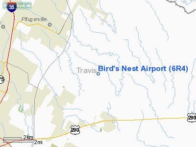
| From nearest city: | 12 nautical miles NE of Austin, TX |
| Location: | Travis County, TX |
| Magnetic Variation: | 07E (1980) |
Owner & Manager
| Ownership: | Privately owned |
| Owner: | Travis County Field, Llc. |
| Address: | 2916 Cardiff Rd
Brookshire, TX 77423 |
| Phone number: | 281-945-5414 |
| Manager: | Jim Craig |
| Address: | 15012 Fuchs Grove Road
Manor, TX 78653 |
| Phone number: | 512-272-5337 |
Airport Operations and Facilities
| Airport Use: | Open to public |
| Wind indicator: | Yes |
| Segmented Circle: | No |
| Control Tower: | No |
| Landing fee charge: | No |
| Sectional chart: | San Antonio |
| Region: | ASW - Southwest |
| Boundary ARTCC: | ZHU - Houston |
| Tie-in FSS: | SJT - San Angelo |
| FSS on Airport: | No |
| FSS Toll Free: | 1-800-WX-BRIEF |
| NOTAMs Facility: | SJT (NOTAM-d service avaliable) |
Airport Communications
Airport Services
| Fuel available: | 100LL
FUEL AVBL 24 HRS WITH CREDIT CARD. |
Runway Information
Runway 16/34
| Dimension: | 2722 x 25 ft / 829.7 x 7.6 m |
| Surface: | ASPH, Fair Condition |
| Weight Limit: | Single wheel: 8000 lbs. |
| |
Runway 16 |
Runway 34 |
| Longitude: | 097-34-05.8094W | 097-33-58.2848W |
| Latitude: | 30-24-00.8282N | 30-23-34.6862N |
| Elevation: | 615.00 ft | 599.00 ft |
| Alignment: | 127 | 127 |
| Traffic Pattern: | Left | Left |
| Markings: | Nonstandard, Good Condition
NRS 20 FT TALL & CNTRLN MARKINGS ONLY. | Nonstandard, Good Condition
NRS 20 FT TALL & CNTRLN MARKINGS ONLY. |
|
Runway SE/NW
| Dimension: | 2230 x 90 ft / 679.7 x 27.4 m |
| Surface: | TURF, Fair Condition |
| |
Runway NW |
Runway SE |
| Traffic Pattern: | Left | Left |
| Obstruction: | , 50:1 slope to clear | 26 ft trees, 30.0 ft from runway, 110 ft left of centerline, 1:1 slope to clear |
|
Radio Navigation Aids
| ID |
Type |
Name |
Ch |
Freq |
Var |
Dist |
| GUO | NDB | Georgetown | | 332.00 | 06E | 18.3 nm |
| GYB | NDB | Lee County | | 385.00 | 07E | 33.5 nm |
| IL | NDB | Iresh | | 278.00 | 07E | 38.4 nm |
| BMQ | NDB | Burnet | | 341.00 | 07E | 40.3 nm |
| MFS | NDB | Horseshoe Bay Resort | | 403.00 | 07E | 41.7 nm |
| HLR | NDB | Hood | | 347.00 | 07E | 44.7 nm |
| GR | NDB | Starn | | 323.00 | 07E | 49.1 nm |
| GRK | VOR/DME | Gray | 055X | 111.80 | 07E | 40.3 nm |
| TPL | VOR/DME | Temple | 041X | 110.40 | 09E | 49.4 nm |
| CWK | VORTAC | Centex | 075X | 112.80 | 06E | 2.2 nm |
Remarks
- ACFT TIEDOWNS & BLDGS WITHIN PRIMARY SFC.
- TWY UNMARKED.
Images and information placed above are from
http://www.airport-data.com/airport/6R4/
We thank them for the data!
| General Info
|
| Country |
United States
|
| State |
TEXAS
|
| FAA ID |
6R4
|
| Latitude |
30-23-47.800N
|
| Longitude |
097-34-02.100W
|
| Elevation |
615 feet
|
| Near City |
AUSTIN
|
We don't guarantee the information is fresh and accurate. The data may
be wrong or outdated.
For more up-to-date information please refer to other sources.
|
|


