 |
|
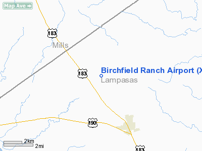
Location & QuickFacts
| FAA Information Effective: | 2008-09-25 |
| Airport Identifier: | XA44 |
| Airport Status: | Operational |
| Longitude/Latitude: | 098-25-26.0000W/31-15-58.0000N
-98.423889/31.266111 (Estimated) |
| Elevation: | 1550 ft / 472.44 m (Estimated) |
| Land: | 11 acres |
| From nearest city: | 4 nautical miles N of Lometa, TX |
| Location: | Lampasas County, TX |
| Magnetic Variation: | () |
Owner & Manager
| Ownership: | Privately owned |
| Owner: | Walt & Joanne Birchfield |
| Address: | 565 Cr 2636
Lometa, TX 76853 |
| Phone number: | 512-752-4073 |
| Manager: | Walt & Joanne Birchfield |
| Address: | 565 Cr 2636
Lometa, TX 76853 |
| Phone number: | 512-752-4073 |
Airport Operations and Facilities
| Airport Use: | Private |
| Wind indicator: | Yes |
| Control Tower: | No |
| Sectional chart: | San Antonio |
| Region: | ASW - Southwest |
| Boundary ARTCC: | ZHU - Houston |
| Tie-in FSS: | SJT - San Angelo |
| FSS Toll Free: | 1-800-WX-BRIEF |
Runway Information
Runway 18/36
| Dimension: | 2200 x 75 ft / 670.6 x 22.9 m |
| Surface: | TURF, Fair Condition |
| |
Runway 18 |
Runway 36 |
| Traffic Pattern: | Left | Left |
|
Radio Navigation Aids
| ID |
Type |
Name |
Ch |
Freq |
Var |
Dist |
| MNZ | NDB | Hamilton | | 251.00 | 07E | 25.6 nm |
| GR | NDB | Starn | | 323.00 | 07E | 28.7 nm |
| BMQ | NDB | Burnet | | 341.00 | 07E | 33.1 nm |
| HLR | NDB | Hood | | 347.00 | 07E | 37.5 nm |
| IL | NDB | Iresh | | 278.00 | 07E | 39.6 nm |
| MFS | NDB | Horseshoe Bay Resort | | 403.00 | 07E | 44.8 nm |
| BBD | NDB | Brady | | 380.00 | 07E | 46.5 nm |
| GRK | VOR/DME | Gray | 055X | 111.80 | 07E | 34.4 nm |
| BWD | VOR/DME | Brownwood | 023X | 108.60 | 08E | 46.5 nm |
| LZZ | VORTAC | Lampasas | 072X | 112.50 | 08E | 15.3 nm |
| LLO | VORTAC | Llano | 019X | 108.20 | 08E | 33.9 nm |
Remarks
- SEE AIRSPACE LETTER DATED 10/27/04 FOR CONDITIONS.
Images and information placed above are from
http://www.airport-data.com/airport/XA44/
We thank them for the data!
|
|


