 |
|
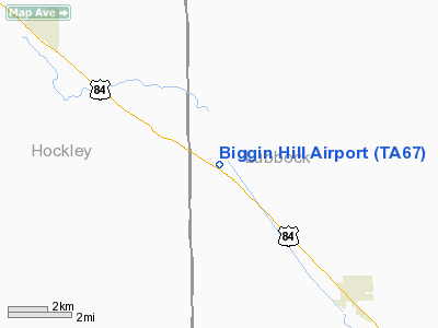
Location & QuickFacts
| FAA Information Effective: | 2008-09-25 |
| Airport Identifier: | TA67 |
| Airport Status: | Operational |
| Longitude/Latitude: | 102-04-01.6240W/33-44-54.3100N
-102.067118/33.748419 (Estimated) |
| Elevation: | 3330 ft / 1014.98 m (Estimated) |
| Land: | 160 acres |
| From nearest city: | 5 nautical miles W of Shallowater, TX |
| Location: | Lubbock County, TX |
| Magnetic Variation: | 09E (1985) |
Owner & Manager
| Ownership: | Privately owned |
| Owner: | Biggin Hill Assoc |
| Address: | C/o Dennis Way, Rt 1, Box 15
Shallowater, TX 79363 |
| Phone number: | 806-873-3400 |
| Manager: | Dennis Way |
| Address: | Route 1 Box 15
Shallowater, TX 79363 |
| Phone number: | 806-873-3400 |
Airport Operations and Facilities
| Airport Use: | Private |
| Wind indicator: | No |
| Segmented Circle: | No |
| Control Tower: | No |
| Landing fee charge: | No |
| Sectional chart: | Albuquerque |
| Region: | ASW - Southwest |
| Boundary ARTCC: | ZFW - Fort Worth |
| Tie-in FSS: | FTW - Fort Worth |
| FSS on Airport: | No |
| FSS Phone: | 817-541-3474 |
| FSS Toll Free: | 1-800-WX-BRIEF |
Runway Information
Runway 12/30
| Dimension: | 3000 x 60 ft / 914.4 x 18.3 m |
| Surface: | TURF, Good Condition |
| |
Runway 12 |
Runway 30 |
| Traffic Pattern: | Left | Left |
| Obstruction: | | 30 ft plines, 400.0 ft from runway |
|
Radio Navigation Aids
| ID |
Type |
Name |
Ch |
Freq |
Var |
Dist |
| LIU | NDB | Littlefield | | 212.00 | 10E | 19.0 nm |
| LLN | NDB | Levelland | | 266.00 | 09E | 19.3 nm |
| BFE | NDB | Brownfield | | 311.00 | 09E | 34.8 nm |
| CZX | NDB | Crosbyton | | 332.00 | 09E | 42.1 nm |
| PVW | VOR/DME | Plainview | 076X | 112.90 | 11E | 24.6 nm |
| LBB | VORTAC | Lubbock | 029X | 109.20 | 11E | 8.1 nm |
Remarks
- E111 PPR; USERS CNTC COL J.H. BROTHERSTON; DEP CMDR FOR OPNS; REESE AFB; FOR SPEC FLGT PROCS/PATS IAW AF NEGOTIATIONS.
Images and information placed above are from
http://www.airport-data.com/airport/TA67/
We thank them for the data!
| General Info
|
| Country |
United States
|
| State |
TEXAS
|
| FAA ID |
TX49
|
| Latitude |
30-07-05.780N
|
| Longitude |
095-51-35.826W
|
| Elevation |
250 feet
|
| Near City |
HOCKLEY
|
We don't guarantee the information is fresh and accurate. The data may
be wrong or outdated.
For more up-to-date information please refer to other sources.
|
|


