 |
|
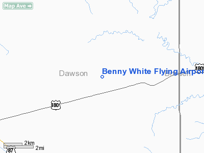
Benny White Flying Airport |
Location & QuickFacts
| FAA Information Effective: | 2008-09-25 |
| Airport Identifier: | XA77 |
| Airport Status: | Operational |
| Longitude/Latitude: | 101-46-46.0000W/32-44-55.0000N
-101.779444/32.748611 (Estimated) |
| Elevation: | 2943 ft / 897.03 m (Estimated) |
| Land: | 9 acres |
| From nearest city: | 5 nautical miles E of Lamesa, TX |
| Location: | Dawson County, TX |
| Magnetic Variation: | () |
Owner & Manager
| Ownership: | Privately owned |
| Owner: | Benny & Ray White |
| Address: | 2112 Cr 20
Lamesa, TX 79331 |
| Phone number: | 806-497-6426 |
| Manager: | Benny & Ray White |
| Address: | 2112 Cr 20
Lamesa, TX 79331 |
| Phone number: | 806-497-6426 |
Airport Operations and Facilities
| Airport Use: | Private |
| Control Tower: | No |
| Sectional chart: | Dallas-ft Worth |
| Region: | ASW - Southwest |
| Boundary ARTCC: | ZFW - Fort Worth |
| Tie-in FSS: | FTW - Fort Worth |
| FSS Phone: | 817-541-3474 |
| FSS Toll Free: | 1-800-WX-BRIEF |
Runway Information
Runway 15/33
| Dimension: | 4150 x 40 ft / 1264.9 x 12.2 m |
| Surface: | DIRT, |
| |
Runway 15 |
Runway 33 |
| Traffic Pattern: | Left | Left |
|
Radio Navigation Aids
| ID |
Type |
Name |
Ch |
Freq |
Var |
Dist |
| LSA | NDB | Lamesa | | 338.00 | 09E | 6.9 nm |
| BFE | NDB | Brownfield | | 311.00 | 09E | 33.2 nm |
| SDR | NDB | Snyder | | 359.00 | 08E | 42.2 nm |
| GNC | NDB | Gaines County | | 344.00 | 09E | 44.1 nm |
| ANR | NDB | Andrews | | 245.00 | 09E | 45.3 nm |
| BGS | VORTAC | Big Spring | 090X | 114.30 | 11E | 26.5 nm |
| MAF | VORTAC | Midland | 095X | 114.80 | 11E | 49.1 nm |
Remarks
- OWNER DESIRES ARPT NOT BE CHARTED.
- PRVDD VFR.
Images and information placed above are from
http://www.airport-data.com/airport/XA77/
We thank them for the data!
|
|


