 |
|
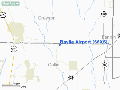
Location & QuickFacts
| FAA Information Effective: | 2008-09-25 |
| Airport Identifier: | 66XS |
| Airport Status: | Operational |
| Longitude/Latitude: | 096-29-18.9490W/33-23-47.3990N
-96.488597/33.396500 (Estimated) |
| Elevation: | 685 ft / 208.79 m (Estimated) |
| Land: | 30 acres |
| From nearest city: | 5 nautical miles N of Westminster, TX |
| Location: | Collin County, TX |
| Magnetic Variation: | 06E (1995) |
Owner & Manager
| Ownership: | Privately owned |
| Owner: | Amy B Baylie |
| Address: | 17110 Fm 3133
Van Alstyne, TX 75495 |
| Phone number: | 972-924-2096 |
| Manager: | Gary W Haass |
| Address: | 17110 Fm 3133
Van Alstyne, TX 75495 |
| Phone number: | 972-924-2096 |
Airport Operations and Facilities
| Airport Use: | Private |
| Wind indicator: | Yes |
| Segmented Circle: | No |
| Control Tower: | No |
| Lighting Schedule: | RDO-CTL
ACTVT LIRL RY 13/31 - 122.9. |
| Sectional chart: | Dallas-ft Worth |
| Region: | ASW - Southwest |
| Boundary ARTCC: | ZFW - Fort Worth |
| Tie-in FSS: | FTW - Fort Worth |
| FSS on Airport: | No |
| FSS Phone: | 817-541-3474 |
| FSS Toll Free: | 1-800-WX-BRIEF |
Runway Information
Runway 13/31
| Dimension: | 2200 x 50 ft / 670.6 x 15.2 m |
| Surface: | TURF, Fair Condition |
| Edge Lights: | Low |
| |
Runway 13 |
Runway 31 |
| Traffic Pattern: | Left | Right |
| Obstruction: | | 70 ft trees, 200.0 ft from runway |
|
Radio Navigation Aids
| ID |
Type |
Name |
Ch |
Freq |
Var |
Dist |
| HJM | NDB | Rayburn | | 415.00 | 06E | 20.4 nm |
| MII | NDB | Caddo Mills | | 316.00 | 06E | 24.6 nm |
| DNI | NDB | Denison | | 341.00 | 06E | 27.2 nm |
| SYW | NDB | Cash | | 428.00 | 05E | 32.7 nm |
| DUA | NDB | Durant | | 359.00 | 05E | 33.1 nm |
| PQF | NDB | Mesquite | | 248.00 | 06E | 35.4 nm |
| AVZ | NDB | Travis | | 260.00 | 06E | 40.1 nm |
| GLE | NDB | Gainesville | | 330.00 | 06E | 40.5 nm |
| JUG | NDB | Jecca | | 388.00 | 06E | 43.8 nm |
| RBD | NDB | Redbird | | 287.00 | 06E | 47.4 nm |
| MJF | TACAN | Arvilla | 033X | | 05E | 29.2 nm |
| URH | VOR/DME | Texoma | 090X | 114.30 | 05E | 33.3 nm |
| CVE | VOR/DME | Cowboy | 109X | 116.20 | 06E | 36.9 nm |
| TTT | VOR/DME | Maverick | 078X | 113.10 | 06E | 42.1 nm |
| SLR | VOR/DME | Sulphur Springs | 027X | 109.00 | 08E | 49.0 nm |
| BYP | VORTAC | Bonham | 093X | 114.60 | 06E | 15.3 nm |
| FUZ | VORTAC | Ranger | 104X | 115.70 | 06E | 46.2 nm |
| DAL | VOT | Dallas Love Field | | 113.30 | | 37.7 nm |
Remarks
- PARACHUTE JUMPING ACTIVITY ON & INVOF ARPT DALGT HRS ONLY.
Images and information placed above are from
http://www.airport-data.com/airport/66XS/
We thank them for the data!
| General Info
|
| Country |
United States
|
| State |
TEXAS
|
| FAA ID |
66XS
|
| Latitude |
33-23-47.399N
|
| Longitude |
096-29-18.949W
|
| Elevation |
685 feet
|
| Near City |
WESTMINSTER
|
We don't guarantee the information is fresh and accurate. The data may
be wrong or outdated.
For more up-to-date information please refer to other sources.
|
|


