 |
|
Location & QuickFacts
| FAA Information Effective: | 2008-09-25 |
| Airport Identifier: | TA46 |
| Airport Status: | Operational |
| Longitude/Latitude: | 096-24-03.9420W/32-33-45.4890N
-96.401095/32.562636 (Estimated) |
| Elevation: | 500 ft / 152.40 m (Estimated) |
| Land: | 33 acres |
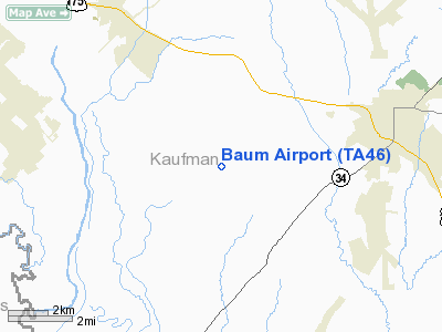
| From nearest city: | 3 nautical miles SW of Kaufman, TX |
| Location: | Kaufman County, TX |
| Magnetic Variation: | 06E (1985) |
Owner & Manager
| Ownership: | Privately owned |
| Owner: | Thomas J. Baum |
| Address: | 6072 Fm 1390
Kaufman, TX 75142 |
| Phone number: | 214-452-8466 |
| Manager: | Thomas J. Baum |
| Address: | 6072 Fm 1390
Kaufman, TX 75142 |
| Phone number: | 214-452-8466 |
Airport Operations and Facilities
| Airport Use: | Private |
| Wind indicator: | Yes |
| Segmented Circle: | No |
| Control Tower: | No |
| Lighting Schedule: | PHONE REQ
FOR LIRL RWY 15/33 & ROTG BCN CALL 214-452-8466. |
| Beacon Color: | Clear-Green (lighted land airport) |
| Landing fee charge: | No |
| Sectional chart: | Dallas-ft Worth |
| Region: | ASW - Southwest |
| Boundary ARTCC: | ZFW - Fort Worth |
| Tie-in FSS: | FTW - Fort Worth |
| FSS on Airport: | No |
| FSS Phone: | 817-541-3474 |
| FSS Toll Free: | 1-800-WX-BRIEF |
Runway Information
Runway 15/33
| Dimension: | 3200 x 80 ft / 975.4 x 24.4 m |
| Surface: | TURF, |
| Edge Lights: | Low |
| |
Runway 15 |
Runway 33 |
| Traffic Pattern: | Left | Left |
| Obstruction: | | 35 ft pline, 400.0 ft from runway |
|
Radio Navigation Aids
| ID |
Type |
Name |
Ch |
Freq |
Var |
Dist |
| JUG | NDB | Jecca | | 388.00 | 06E | 9.2 nm |
| AVZ | NDB | Travis | | 260.00 | 06E | 14.1 nm |
| PQF | NDB | Mesquite | | 248.00 | 06E | 16.2 nm |
| LNC | NDB | Lancaster | | 239.00 | 06E | 16.3 nm |
| RBD | NDB | Redbird | | 287.00 | 06E | 24.8 nm |
| XQH | NDB | Cedar Hill | | 353.00 | 08E | 29.2 nm |
| MII | NDB | Caddo Mills | | 316.00 | 06E | 29.7 nm |
| CGQ | NDB | Powell | | 344.00 | 06E | 30.0 nm |
| SYW | NDB | Cash | | 428.00 | 05E | 30.3 nm |
| CRS | NDB | Corsicana | | 396.00 | 06E | 32.2 nm |
| CSZ | NDB | Crossroads | | 215.00 | 08E | 37.5 nm |
| AHX | NDB | Athens | | 269.00 | 06E | 37.8 nm |
| LIQ | NDB | Lochridge Ranch | | 335.00 | 09E | 40.2 nm |
| PYF | NDB | Pyramid | | 418.00 | 06E | 43.3 nm |
| TY | NDB | Tyler | | 320.00 | 06E | 48.0 nm |
| MJF | TACAN | Arvilla | 033X | | 05E | 34.8 nm |
| CVE | VOR/DME | Cowboy | 109X | 116.20 | 06E | 32.2 nm |
| TTT | VOR/DME | Maverick | 078X | 113.10 | 06E | 37.2 nm |
| CQY | VORTAC | Cedar Creek | 095X | 114.80 | 06E | 24.5 nm |
| FUZ | VORTAC | Ranger | 104X | 115.70 | 06E | 44.0 nm |
| DAL | VOT | Dallas Love Field | | 113.30 | | 28.5 nm |
Remarks
- E111 PRVDD LNDG THR ON SOUTHEAST END IS DSPLCD TO PRVD 20:1 APCH RATIO WITH 15' CLNC OVER ROAD.
Images and information placed above are from
http://www.airport-data.com/airport/TA46/
We thank them for the data!
| General Info
|
| Country |
United States
|
| State |
TEXAS
|
| FAA ID |
TA46
|
| Latitude |
32-33-45.489N
|
| Longitude |
096-24-03.942W
|
| Elevation |
500 feet
|
| Near City |
KAUFMAN
|
We don't guarantee the information is fresh and accurate. The data may
be wrong or outdated.
For more up-to-date information please refer to other sources.
|
|


