 |
|
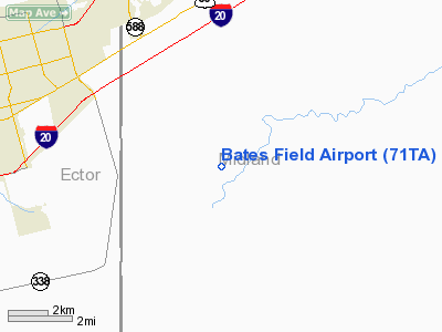
Location & QuickFacts
| FAA Information Effective: | 2008-09-25 |
| Airport Identifier: | 71TA |
| Airport Status: | Operational |
| Longitude/Latitude: | 102-14-01.5030W/31-50-00.4590N
-102.233751/31.833461 (Estimated) |
| Elevation: | 2820 ft / 859.54 m (Estimated) |
| Land: | 320 acres |
| From nearest city: | 7 nautical miles SE of Odessa, TX |
| Location: | Midland County, TX |
| Magnetic Variation: | 09E (1985) |
Owner & Manager
| Ownership: | Privately owned |
| Owner: | Marcus & Mary Bates |
| Address: | 111 West 10th St.
Odessa, TX 79761 |
| Phone number: | 915-563-2885 |
| Manager: | Marcus & Mary Bates |
| Address: | 111 West 10th St.
Odessa, TX 79761 |
| Phone number: | 915-563-2885 |
Airport Operations and Facilities
| Airport Use: | Private |
| Wind indicator: | Yes |
| Segmented Circle: | No |
| Control Tower: | No |
| Lighting Schedule: | DUSK-DAWN |
| Landing fee charge: | No |
| Sectional chart: | San Antonio |
| Region: | ASW - Southwest |
| Boundary ARTCC: | ZFW - Fort Worth |
| Tie-in FSS: | SJT - San Angelo |
| FSS on Airport: | No |
| FSS Toll Free: | 1-800-WX-BRIEF |
Runway Information
Runway 07/25
| Dimension: | 2000 x 60 ft / 609.6 x 18.3 m |
| Surface: | GRVL,
ROLLED AND PACKED CALICHE.
ROLLED AND PACKED CALICHE. |
| |
Runway 07 |
Runway 25 |
| Traffic Pattern: | Left | Left |
|
Runway 16/34
| Dimension: | 4400 x 80 ft / 1341.1 x 24.4 m |
| Surface: | GRVL,
ROLLED AND PACKED CALICHE.
ROLLED AND PACKED CALICHE. |
| Edge Lights: | Low |
| |
Runway 16 |
Runway 34 |
| Traffic Pattern: | Left | Left |
|
Radio Navigation Aids
| ID |
Type |
Name |
Ch |
Freq |
Var |
Dist |
| MA | NDB | Farly | | 326.00 | 09E | 10.4 nm |
| ANR | NDB | Andrews | | 245.00 | 09E | 34.6 nm |
| OHE | NDB | Monahans | | 214.00 | 09E | 37.6 nm |
| MAF | VORTAC | Midland | 095X | 114.80 | 11E | 10.8 nm |
| MAF | VOT | Midland International | | 108.20 | | 6.4 nm |
Remarks
- PRVDD RWY THRS ARE LOCATED TO PROVIDE A MINIMUM 20:1 CLEARANCE OVER ANY & ALL OVERHEAD UTILITY WIRES, FENCES, OTHER MAN-MADE STRUCTURES & OBJECTS OF TERRAIN OR NATURAL GROWTH THAT OBSTRUCT THE APCH AREAS.
Images and information placed above are from
http://www.airport-data.com/airport/71TA/
We thank them for the data!
| General Info
|
| Country |
United States
|
| State |
TEXAS
|
| FAA ID |
71TA
|
| Latitude |
31-50-00.459N
|
| Longitude |
102-14-01.503W
|
| Elevation |
2820 feet
|
| Near City |
ODESSA
|
We don't guarantee the information is fresh and accurate. The data may
be wrong or outdated.
For more up-to-date information please refer to other sources.
|
|


