 |
|
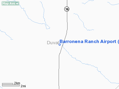
Location & QuickFacts
| FAA Information Effective: | 2008-09-25 |
| Airport Identifier: | 03TE |
| Airport Status: | Operational |
| Longitude/Latitude: | 098-40-10.0610W/27-29-28.1200N
-98.669461/27.491144 (Estimated) |
| Elevation: | 600 ft / 182.88 m (Estimated) |
| Land: | 0 acres |
| From nearest city: | 10 nautical miles N of Hebbronville, TX |
| Location: | Duval County, TX |
| Magnetic Variation: | 07E (1985) |
Owner & Manager
| Ownership: | Privately owned |
| Owner: | Tim Musgrave |
| Address: | 9207 Village Dr
San Antonio, TX 78217 |
| Phone number: | 512-653-2710 |
| Manager: | Tim Musgrave |
| Address: | 477 Sandau
San Antonio, TX 78216 |
| Phone number: | 512-653-2710 |
Airport Operations and Facilities
| Airport Use: | Private |
| Wind indicator: | Yes |
| Segmented Circle: | No |
| Control Tower: | No |
| Landing fee charge: | No |
| Sectional chart: | San Antonio |
| Region: | ASW - Southwest |
| Boundary ARTCC: | ZHU - Houston |
| Tie-in FSS: | SJT - San Angelo |
| FSS on Airport: | No |
| FSS Toll Free: | 1-800-WX-BRIEF |
Runway Information
Runway 12/30
| Dimension: | 3500 x 100 ft / 1066.8 x 30.5 m |
| Surface: | TURF, |
| |
Runway 12 |
Runway 30 |
| Traffic Pattern: | Left | Left |
|
Radio Navigation Aids
| ID |
Type |
Name |
Ch |
Freq |
Var |
Dist |
| HBV | NDB | Hebbronville | | 266.00 | 06E | 9.2 nm |
| TKB | NDB | Kleberg County | | 347.00 | 06E | 31.9 nm |
| BKS | NDB | Brooks County | | 353.00 | 06E | 33.9 nm |
| SNE | NDB | Santa Elena | | 260.00 | 07E | 46.7 nm |
| NOG | TACAN | Orange Grove | 063X | | 09E | 41.3 nm |
| NQI | TACAN | Kingsville | 125X | | 09E | 46.1 nm |
| ALI | VOR | Alice | | 114.50 | 06E | 37.6 nm |
| NLD | VOR/DME | Nuevo Laredo | 073X | 112.60 | 09E | 48.0 nm |
| LRD | VORTAC | Laredo | 121X | 117.40 | 09E | 39.9 nm |
Remarks
- RWY HAZARDOUS AND COMPLETELY FENCED.
- PLINES NW END OF RWY
- VFR USE ONLY.
Images and information placed above are from
http://www.airport-data.com/airport/03TE/
We thank them for the data!
| General Info
|
| Country |
United States
|
| State |
TEXAS
|
| FAA ID |
03TE
|
| Latitude |
27-29-28.120N
|
| Longitude |
098-40-10.061W
|
| Elevation |
600 feet
|
| Near City |
HEBBRONVILLE
|
We don't guarantee the information is fresh and accurate. The data may
be wrong or outdated.
For more up-to-date information please refer to other sources.
|
|


