 |
|
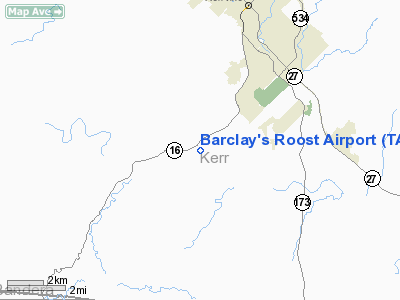
Location & QuickFacts
| FAA Information Effective: | 2008-09-25 |
| Airport Identifier: | TA73 |
| Airport Status: | Operational |
| Longitude/Latitude: | 099-10-06.1450W/29-58-28.7700N
-99.168374/29.974658 (Estimated) |
| Elevation: | 1680 ft / 512.06 m (Estimated) |
| Land: | 42 acres |
| From nearest city: | 6 nautical miles NE of Kerrville, TX |
| Location: | Kerr County, TX |
| Magnetic Variation: | 08E (1985) |
Owner & Manager
| Ownership: | Privately owned |
| Owner: | T.s. Barclay |
| Address: | 101 Springmeadow
Kerrville, TX 78028 |
| Phone number: | 512-257-2297 |
| Manager: | T.s. Barclay |
| Address: | 101 Springmeadow
Kerrville, TX 78028 |
| Phone number: | 512-257-2297 |
Airport Operations and Facilities
| Airport Use: | Private |
| Wind indicator: | Yes |
| Segmented Circle: | No |
| Control Tower: | No |
| Lighting Schedule: | PHONE REQ
FOR LIRL RY 15/33 CALL 512-257-2297. |
| Sectional chart: | San Antonio |
| Region: | ASW - Southwest |
| Boundary ARTCC: | ZHU - Houston |
| Tie-in FSS: | SJT - San Angelo |
| FSS on Airport: | No |
| FSS Toll Free: | 1-800-WX-BRIEF |
Airport Services
Runway Information
Runway 15/33
| Dimension: | 2200 x 50 ft / 670.6 x 15.2 m |
| Surface: | TURF, |
| Edge Lights: | Low |
| |
Runway 15 |
Runway 33 |
| Traffic Pattern: | Left | Left |
| Displaced threshold: | 150.00 ft | 0.00 ft |
| Obstruction: | 35 ft pline, 25.0 ft from runway | |
|
Radio Navigation Aids
| ID |
Type |
Name |
Ch |
Freq |
Var |
Dist |
| ER | NDB | Shein | | 263.00 | 08E | 9.0 nm |
| HMA | NDB | Hondo | | 329.00 | 08E | 36.1 nm |
| CVB | NDB | Castroville | | 338.00 | 08E | 41.3 nm |
| KSY | TACAN | Kelly | 057X | | 07E | 46.6 nm |
| HDO | VOR/DME | Hondo | 31X | 109.40 | 08E | 37.6 nm |
| CSI | VORTAC | Center Point | 122X | 117.50 | 08E | 4.0 nm |
| STV | VORTAC | Stonewall | 085X | 113.80 | 08E | 27.8 nm |
| SAT | VORTAC | San Antonio | 115X | 116.80 | 08E | 41.9 nm |
| SAT | VOT | San Antonio Intl | | 110.40 | | 45.1 nm |
Images and information placed above are from
http://www.airport-data.com/airport/TA73/
We thank them for the data!
| General Info
|
| Country |
United States
|
| State |
TEXAS
|
| FAA ID |
TA73
|
| Latitude |
29-58-28.770N
|
| Longitude |
099-10-06.145W
|
| Elevation |
1680 feet
|
| Near City |
KERRVILLE
|
We don't guarantee the information is fresh and accurate. The data may
be wrong or outdated.
For more up-to-date information please refer to other sources.
|
|


