 |
|
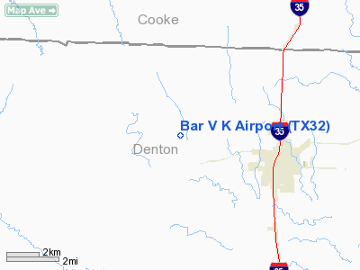
Location & QuickFacts
| FAA Information Effective: | 2008-09-25 |
| Airport Identifier: | TX32 |
| Airport Status: | Operational |
| Longitude/Latitude: | 097-14-36.0000W/33-22-35.0000N
-97.243333/33.376389 (Estimated) |
| Elevation: | 765 ft / 233.17 m (Estimated) |
| Land: | 0 acres |
| From nearest city: | 1 nautical miles N of Bolivar, TX |
| Location: | Denton County, TX |
| Magnetic Variation: | 07E (1985) |
Owner & Manager
| Ownership: | Privately owned |
| Owner: | Bar V K Air Ranch Estates Assoc Inc |
| Address: | 11745 Merlin Drive
Sanger, TX 76266-3925 |
| Phone number: | 817-458-5515 |
| Manager: | Merlin Shippey |
| Address: | Po Box 279
Sanger, TX 76266-0279 |
| Phone number: | 817-458-7166 |
Airport Operations and Facilities
| Airport Use: | Private |
| Wind indicator: | Yes |
| Segmented Circle: | No |
| Control Tower: | No |
| Lighting Schedule: | RDO-CTL
ACTVT LIRL RY 18/36 - 122.85. |
| Landing fee charge: | No |
| Sectional chart: | Dallas-ft Worth |
| Region: | ASW - Southwest |
| Boundary ARTCC: | ZFW - Fort Worth |
| Tie-in FSS: | FTW - Fort Worth |
| FSS on Airport: | No |
| FSS Phone: | 817-541-3474 |
| FSS Toll Free: | 1-800-WX-BRIEF |
Airport Services
| Airframe Repair: | NONE |
| Power Plant Repair: | NONE |
Runway Information
Runway 18/36
| Dimension: | 2900 x 100 ft / 883.9 x 30.5 m |
| Surface: | TURF,
RY 18/36 SLOPES; ROLLING TERRAIN ALL QUADRANTS. |
| Edge Lights: | Low |
| |
Runway 18 |
Runway 36 |
| Traffic Pattern: | Left | Left |
| Obstruction: | 15 ft road | 2 ft berm, 90.0 ft from runway |
|
Radio Navigation Aids
| ID |
Type |
Name |
Ch |
Freq |
Var |
Dist |
| GLE | NDB | Gainesville | | 330.00 | 06E | 20.7 nm |
| GMZ | NDB | Grindstone Mountain | | 356.00 | 07E | 29.9 nm |
| DNI | NDB | Denison | | 341.00 | 06E | 39.4 nm |
| RBD | NDB | Redbird | | 287.00 | 06E | 46.0 nm |
| AUV | NDB | Arbuckle | | 284.00 | 07E | 46.9 nm |
| XQH | NDB | Cedar Hill | | 353.00 | 08E | 49.1 nm |
| PQF | NDB | Mesquite | | 248.00 | 06E | 49.5 nm |
| NFW | TACAN | Nas Jrb Fort Worth | 024X | | 07E | 37.7 nm |
| TTT | VOR/DME | Maverick | 078X | 113.10 | 06E | 32.2 nm |
| CVE | VOR/DME | Cowboy | 109X | 116.20 | 06E | 33.8 nm |
| FUZ | VORTAC | Ranger | 104X | 115.70 | 06E | 29.4 nm |
| UKW | VORTAC | Bowie | 071X | 112.40 | 06E | 30.5 nm |
| FTW | VOT | Fort Worth Meacham | | 108.20 | | 34.1 nm |
| DAL | VOT | Dallas Love Field | | 113.30 | | 37.4 nm |
Remarks
- PAEW ON RY.
- WILDLIFE ON & INVOF RY.
- STANDING WATER MIDFIELD DURG & AFT RAIN. RY SOFT WHEN WET.
- FENCE MIDFIELD ON WEST SIDE OF RY 70 FT FM RY CNTRLN, TREES BOTH SIDES OF RY 75 FT FM RY CNTRLN.
- CULVERT MIDFIELD WITH DITCH ON BOTH SIDES OF RY.
- GLIDER ACTIVITY ON & INVOF ARPT.
- RIGHT TRAFFIC FOR GLIDERS ONLY.
Images and information placed above are from
http://www.airport-data.com/airport/TX32/
We thank them for the data!
| General Info
|
| Country |
United States
|
| State |
TEXAS
|
| FAA ID |
TX32
|
| Latitude |
33-22-35.000N
|
| Longitude |
097-14-36.000W
|
| Elevation |
765 feet
|
| Near City |
BOLIVAR
|
We don't guarantee the information is fresh and accurate. The data may
be wrong or outdated.
For more up-to-date information please refer to other sources.
|
|


