 |
|
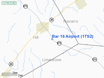
Location & QuickFacts
| FAA Information Effective: | 2008-09-25 |
| Airport Identifier: | 1TS2 |
| Airport Status: | Operational |
| Longitude/Latitude: | 096-46-42.4700W/31-49-27.5700N
-96.778464/31.824325 (Estimated) |
| Elevation: | 547 ft / 166.73 m (Estimated) |
| Land: | 211 acres |
| From nearest city: | 1 nautical miles SE of Hubbard, TX |
| Location: | Hill County, TX |
| Magnetic Variation: | 05E (2000) |
Owner & Manager
| Ownership: | Privately owned |
| Owner: | B. D. Pope |
| Address: | 1708 Woodside Ct
Arlington, TX 76013 |
| Phone number: | 817-429-0975 |
| Manager: | B. D. Pope |
| Address: | 1708 Woodside Ct
Arlington, TX 76013 |
| Phone number: | 817-429-0975 |
Airport Operations and Facilities
| Airport Use: | Private |
| Wind indicator: | Yes |
| Segmented Circle: | No |
| Control Tower: | No |
| Sectional chart: | Houston |
| Region: | ASW - Southwest |
| Boundary ARTCC: | ZFW - Fort Worth |
| Tie-in FSS: | FTW - Fort Worth |
| FSS Phone: | 817-541-3474 |
| FSS Toll Free: | 1-800-WX-BRIEF |
Runway Information
Runway 15/33
| Dimension: | 2500 x 100 ft / 762.0 x 30.5 m |
| Surface: | TURF, |
| |
Runway 15 |
Runway 33 |
| Traffic Pattern: | Left | Left |
|
Radio Navigation Aids
| ID |
Type |
Name |
Ch |
Freq |
Var |
Dist |
| LXY | NDB | Mexia | | 329.00 | 07E | 17.6 nm |
| CGQ | NDB | Powell | | 344.00 | 06E | 23.0 nm |
| CRS | NDB | Corsicana | | 396.00 | 06E | 23.1 nm |
| ROB | NDB | Robinson | | 400.00 | 07E | 24.4 nm |
| PYF | NDB | Pyramid | | 418.00 | 06E | 29.8 nm |
| LIQ | NDB | Lochridge Ranch | | 335.00 | 09E | 43.6 nm |
| CSZ | NDB | Crossroads | | 215.00 | 08E | 44.3 nm |
| LNC | NDB | Lancaster | | 239.00 | 06E | 45.4 nm |
| XQH | NDB | Cedar Hill | | 353.00 | 08E | 47.2 nm |
| GNL | VOR/DME | Groesbeck | 025X | 108.80 | 05E | 18.7 nm |
| TPL | VOR/DME | Temple | 041X | 110.40 | 09E | 49.6 nm |
| ACT | VORTAC | Waco | 100X | 115.30 | 09E | 26.9 nm |
| CQY | VORTAC | Cedar Creek | 095X | 114.80 | 06E | 35.9 nm |
Images and information placed above are from
http://www.airport-data.com/airport/1TS2/
We thank them for the data!
| General Info
|
| Country |
United States
|
| State |
TEXAS
|
| FAA ID |
1TS2
|
| Latitude |
31-49-27.570N
|
| Longitude |
096-46-42.470W
|
| Elevation |
547 feet
|
| Near City |
HUBBARD
|
We don't guarantee the information is fresh and accurate. The data may
be wrong or outdated.
For more up-to-date information please refer to other sources.
|
|


