 |
|
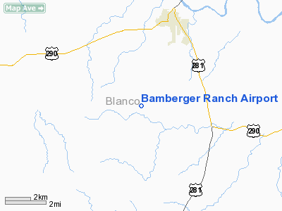
Location & QuickFacts
| FAA Information Effective: | 2008-09-25 |
| Airport Identifier: | 48T |
| Airport Status: | Closed Permanently |
| Longitude/Latitude: | 098-26-01.0830W/30-13-00.7320N
-98.433634/30.216870 (Estimated) |
| Elevation: | 1540 ft / 469.39 m (Estimated) |
| Land: | 0 acres |
| From nearest city: | 4 nautical miles S of Johnson City, TX |
| Location: | Blanco County, TX |
| Magnetic Variation: | 07E (1985) |
Owner & Manager
| Ownership: | Privately owned |
| Owner: | J. David Bamberger |
| Address: | 3539 Oakgate Drive Suite 150
San Antonio, TX 78230 |
| Phone number: | 512-868-7294 |
| Address: |
|
Airport Operations and Facilities
| Airport Use: | Private |
| Wind indicator: | No |
| Segmented Circle: | No |
| Control Tower: | No |
| Landing fee charge: | No |
| Sectional chart: | San Antonio |
| Region: | ASW - Southwest |
| Boundary ARTCC: | ZHU - Houston |
| Tie-in FSS: | SJT - San Angelo |
| FSS on Airport: | No |
| FSS Toll Free: | 1-800-WX-BRIEF |
Airport Services
| Airframe Repair: | NONE |
| Power Plant Repair: | NONE |
Runway Information
Runway N/S
| Dimension: | 1700 x 60 ft / 518.2 x 18.3 m |
| Surface: | DIRT, |
| |
Runway N |
Runway S |
| Traffic Pattern: | Left | Left |
|
Radio Navigation Aids
| ID |
Type |
Name |
Ch |
Freq |
Var |
Dist |
| MFS | NDB | Horseshoe Bay Resort | | 403.00 | 07E | 18.8 nm |
| BMQ | NDB | Burnet | | 341.00 | 07E | 33.1 nm |
| ER | NDB | Shein | | 263.00 | 08E | 35.0 nm |
| GUO | NDB | Georgetown | | 332.00 | 06E | 48.1 nm |
| DHK | TACAN | Randolph | 036X | | 09E | 41.8 nm |
| STV | VORTAC | Stonewall | 085X | 113.80 | 08E | 14.1 nm |
| SAT | VORTAC | San Antonio | 115X | 116.80 | 08E | 34.5 nm |
| LLO | VORTAC | Llano | 019X | 108.20 | 08E | 39.4 nm |
| RND | VORTAC | Randolph | 70X | 112.30 | 09E | 42.6 nm |
| CSI | VORTAC | Center Point | 122X | 117.50 | 08E | 44.3 nm |
| CWK | VORTAC | Centex | 075X | 112.80 | 06E | 47.9 nm |
| SAT | VOT | San Antonio Intl | | 110.40 | | 41.1 nm |
Remarks
- (ARPT STATUS) ARPT CLSD PERMLY.
- PRE DATES THE ACT
Images and information placed above are from
http://www.airport-data.com/airport/48T/
We thank them for the data!
| General Info
|
| Country |
United States
|
| State |
TEXAS
|
| FAA ID |
48T
|
| Latitude |
30-13-00.732N
|
| Longitude |
098-26-01.083W
|
| Elevation |
1540 feet
|
| Near City |
JOHNSON CITY
|
We don't guarantee the information is fresh and accurate. The data may
be wrong or outdated.
For more up-to-date information please refer to other sources.
|
|


