 |
|
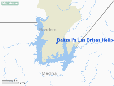
Baltzell's Las Brisas Heliport |
Location & QuickFacts
| FAA Information Effective: | 2008-09-25 |
| Airport Identifier: | 3TA3 |
| Airport Status: | Operational |
| Longitude/Latitude: | 098-56-46.1090W/29-35-17.8210N
-98.946141/29.588284 (Estimated) |
| Elevation: | 1165 ft / 355.09 m (Estimated) |
| Land: | 0 acres |
| From nearest city: | 9 nautical miles SE of Bandera, TX |
| Location: | Bandera County, TX |
| Magnetic Variation: | 07E (1985) |
Owner & Manager
| Ownership: | Privately owned |
| Owner: | Kent F. Baltzell |
| Address: | Box 4562, Route 4
Lake Hills, TX 78063 |
| Phone number: | 512-695-9726 |
| Manager: | Kent F. Baltzell |
| Address: | Box 4562, Route 4
Lake Hills, TX 78063 |
| Phone number: | 512-695-9726 |
Airport Operations and Facilities
| Airport Use: | Private |
| Wind indicator: | Yes |
| Segmented Circle: | No |
| Control Tower: | No |
| Landing fee charge: | No |
| Sectional chart: | San Antonio |
| Region: | ASW - Southwest |
| Boundary ARTCC: | ZHU - Houston |
| Tie-in FSS: | SJT - San Angelo |
| FSS on Airport: | No |
| FSS Toll Free: | 1-800-WX-BRIEF |
Runway Information
Helipad H1
| Dimension: | 40 x 15 ft / 12.2 x 4.6 m
40'X15' TD WI A 120''X75' LNDG/TO AREA. |
| Surface: | ASPH, |
| |
Runway H1 |
Runway |
| Traffic Pattern: | Left | Left |
| Obstruction: | 125 ft hill, 2640.0 ft from runway | |
|
Radio Navigation Aids
| ID |
Type |
Name |
Ch |
Freq |
Var |
Dist |
| CVB | NDB | Castroville | | 338.00 | 08E | 15.4 nm |
| HMA | NDB | Hondo | | 329.00 | 08E | 17.5 nm |
| ER | NDB | Shein | | 263.00 | 08E | 19.9 nm |
| HHH | NDB | Devine | | 359.00 | 07E | 27.0 nm |
| PEZ | NDB | Pleasanton | | 275.00 | 07E | 44.2 nm |
| UVA | NDB | Uvalde | | 281.00 | 07E | 47.7 nm |
| KSY | TACAN | Kelly | 057X | | 07E | 22.5 nm |
| DHK | TACAN | Randolph | 036X | | 09E | 35.6 nm |
| SSF | VOR | Stinson | | 108.40 | 09E | 33.0 nm |
| HDO | VOR/DME | Hondo | 31X | 109.40 | 08E | 18.8 nm |
| CSI | VORTAC | Center Point | 122X | 117.50 | 08E | 24.5 nm |
| SAT | VORTAC | San Antonio | 115X | 116.80 | 08E | 25.6 nm |
| RND | VORTAC | Randolph | 70X | 112.30 | 09E | 34.8 nm |
| STV | VORTAC | Stonewall | 085X | 113.80 | 08E | 39.2 nm |
| SAT | VOT | San Antonio Intl | | 110.40 | | 25.1 nm |
Remarks
- PRVDD OPNS ARE RESTRICTED TO VFR WEATHER CONDITIONS.
Images and information placed above are from
http://www.airport-data.com/airport/3TA3/
We thank them for the data!
| General Info
|
| Country |
United States
|
| State |
TEXAS
|
| FAA ID |
3TA3
|
| Latitude |
29-35-17.821N
|
| Longitude |
098-56-46.109W
|
| Elevation |
1165 feet
|
| Near City |
BANDERA
|
We don't guarantee the information is fresh and accurate. The data may
be wrong or outdated.
For more up-to-date information please refer to other sources.
|
|


