 |
|
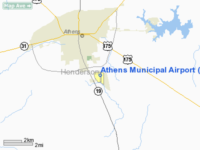
Location & QuickFacts
| FAA Information Effective: | 2008-09-25 |
| Airport Identifier: | F44 |
| Airport Status: | Operational |
| Longitude/Latitude: | 095-49-42.0710W/32-09-49.8520N
-95.828353/32.163848 (Estimated) |
| Elevation: | 444 ft / 135.33 m (Surveyed) |
| Land: | 65 acres |
| From nearest city: | 3 nautical miles SE of Athens, TX |
| Location: | Henderson County, TX |
| Magnetic Variation: | 06E (1990) |
Owner & Manager
| Ownership: | Publicly owned |
| Owner: | City Of Athens |
| Address: | 508 E. Tyler
Athens, TX 75751 |
| Phone number: | 903-675-5131 |
| Manager: | Pam Burton
CITY MANAGER. |
| Address: | 508 E. Tyler
Athens, TX 75751 |
| Phone number: | 903-675-5131 |
Airport Operations and Facilities
| Airport Use: | Open to public |
| Wind indicator: | Yes |
| Segmented Circle: | Yes |
| Control Tower: | No |
| Lighting Schedule: | DUSK-DAWN |
| Beacon Color: | Clear-Green (lighted land airport) |
| Landing fee charge: | No |
| Sectional chart: | Dallas-ft Worth |
| Region: | ASW - Southwest |
| Boundary ARTCC: | ZFW - Fort Worth |
| Tie-in FSS: | FTW - Fort Worth |
| FSS on Airport: | No |
| FSS Phone: | 817-541-3474 |
| FSS Toll Free: | 1-800-WX-BRIEF |
| NOTAMs Facility: | FTW (NOTAM-d service avaliable) |
| Federal Agreements: | NGY |
Airport Communications
| CTAF: | 123.000 |
| Unicom: | 123.000 |
Airport Services
| Fuel available: | 100LLA
FOR FUEL AFT HRS CALL 903-677-1897. |
| Airframe Repair: | MINOR |
| Power Plant Repair: | MINOR |
| Bottled Oxygen: | NONE |
| Bulk Oxygen: | NONE |
Runway Information
Runway 17/35
| Dimension: | 3988 x 60 ft / 1215.5 x 18.3 m |
| Surface: | ASPH, Good Condition |
| Weight Limit: | Single wheel: 25000 lbs. |
| Edge Lights: | Medium |
| |
Runway 17 |
Runway 35 |
| Longitude: | 095-49-42.1646W | 095-49-42.0139W |
| Latitude: | 32-10-09.6288N | 32-09-30.1649N |
| Elevation: | 438.00 ft | 437.00 ft |
| Alignment: | 127 | 127 |
| Traffic Pattern: | Left | Right |
| Markings: | Non-precision instrument, Good Condition | Non-precision instrument, Good Condition |
| Crossing Height: | 31.00 ft | 40.00 ft |
| VASI: | 2-light PAPI on left side | 2-light PAPI on left side |
| Visual Glide Angle: | 3.00° | 4.00° |
| Obstruction: | 5 ft fence, 200.0 ft from runway, 225 ft left of centerline
11 FT ROAD 0-200 FT FM THLD 240 FT L; 4 FT FENCE 225 FT L. | 5 ft fence, 200.0 ft from runway, 247 ft right of centerline
5 FT FENCE 0-200 FT FM THLD 247 FT R. |
|
Radio Navigation Aids
| ID |
Type |
Name |
Ch |
Freq |
Var |
Dist |
| AHX | NDB | Athens | | 269.00 | 06E | 0.3 nm |
| CSZ | NDB | Crossroads | | 215.00 | 08E | 8.9 nm |
| LIQ | NDB | Lochridge Ranch | | 335.00 | 09E | 11.2 nm |
| TY | NDB | Tyler | | 320.00 | 06E | 23.7 nm |
| PSN | NDB | Palestine | | 375.00 | 04E | 24.0 nm |
| PYF | NDB | Pyramid | | 418.00 | 06E | 26.1 nm |
| CRS | NDB | Corsicana | | 396.00 | 06E | 30.0 nm |
| CGQ | NDB | Powell | | 344.00 | 06E | 31.1 nm |
| JSO | NDB | Cherokee County | | 263.00 | 05E | 35.9 nm |
| AVZ | NDB | Travis | | 260.00 | 06E | 41.7 nm |
| ABG | NDB | Ambassador | | 404.00 | 07E | 44.3 nm |
| JUG | NDB | Jecca | | 388.00 | 06E | 46.8 nm |
| LXY | NDB | Mexia | | 329.00 | 07E | 47.0 nm |
| HNO | NDB | Henderson | | 371.00 | 06E | 49.2 nm |
| FZT | VOR/DME | Frankston | 051X | 111.40 | 06E | 16.1 nm |
| TYR | VOR/DME | Tyler | 089X | 114.20 | 06E | 24.5 nm |
| UIM | VOR/DME | Quitman | 087X | 114.00 | 08E | 49.0 nm |
| CQY | VORTAC | Cedar Creek | 095X | 114.80 | 06E | 19.9 nm |
Remarks
Images and information placed above are from
http://www.airport-data.com/airport/F44/
We thank them for the data!
| General Info
|
| Country |
United States
|
| State |
TEXAS
|
| FAA ID |
F44
|
| Latitude |
32-09-49.852N
|
| Longitude |
095-49-42.071W
|
| Elevation |
444 feet
|
| Near City |
ATHENS
|
We don't guarantee the information is fresh and accurate. The data may
be wrong or outdated.
For more up-to-date information please refer to other sources.
|
|


